
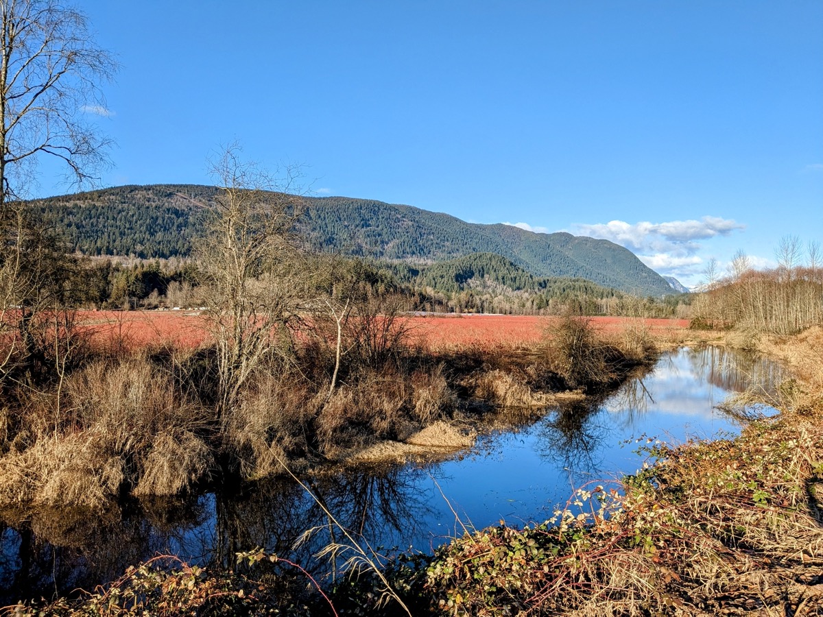
Ever since we moved to Coquitlam in 2020, I have been wanting to explore Pinecone Burke Provincial Park, which is literally in the city’s backyard. While the provincial park is huge and spans a wide area from Pitt Lake in the south to Garibaldi Park in the north, my interest has lain in hiking different parts of the Burke Mountain, which forms the southern boundary of the park.
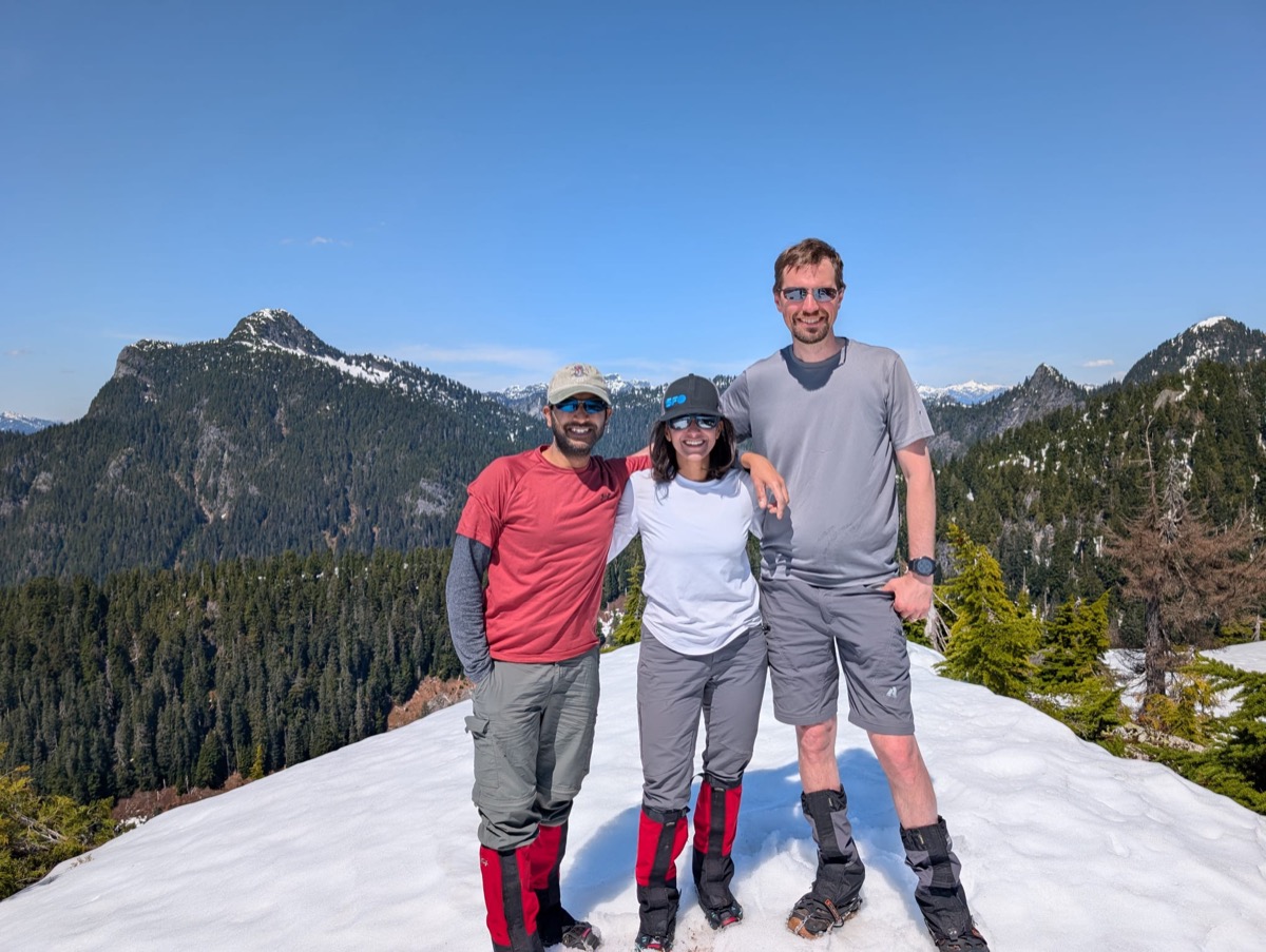
Pika peak and North Burke summit are the high bumps on the Burke Mountain ridge. They are not visible from the city and do not look like prominent peaks, but I found the the idea of traversing the ridge to get to these summits appealing. After two failed attempts to get there via the Hourglass Lake route (once due to bad weather, a second time due to running out of daylight), I decided to make things easier for ourselves. In the modified plan, I was joined by my partner Abhi and our neighbor and good friend, Nathanael.
Trip Stats
- Location: Pika peak, Burke Mountain, Pinecone Burke Provincial Park
- Date: May 2, 2026
- Trailhead to Trailhead Time & Distance: 7 hours, 13.5km
- Route: Harper road- Old Ski Lodge on Burke Ridge- Pika Peak
- Gear: Microspikes, Snowshoes
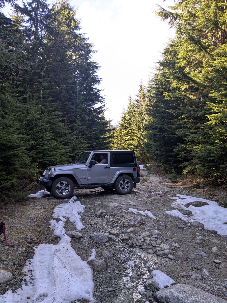
- Things to note: 1. Even on a 23C day, Burke ridge had spring conditions and was fully under snow cover, including Ted Kay lake. 2. If driving on Harper road, you need access to gate keys and a high-clearance, AWD vehicle. Otherwise, just walk on Harper road or take the Hourglass Lake or Dennett lake trail variations to the ridge.
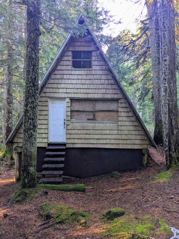
With Nathanael’s jeep and my access to the keys to BC Parks/BC Hydro gates on Harper road, we were able to drive up to the Village Lakes Trail(VLT) junction, at around 900m elevation. Due to the rough nature of the road, it took us almost 35-40 mins to drive the 5km stretch. Our plan was to spend the night at the Coquitlam SAR cabin on the VLT and get an early start for the hike up to Pika peak the next morning.
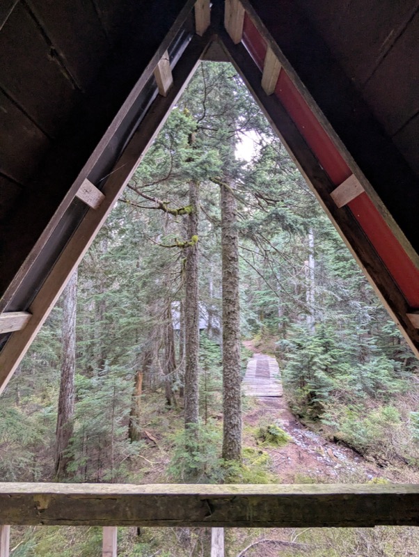
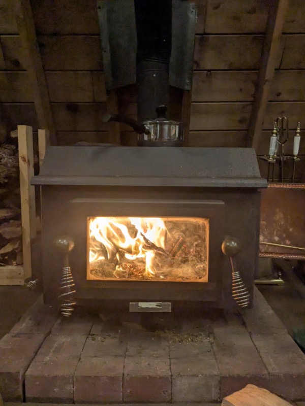
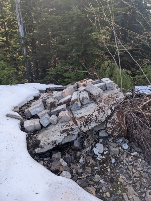
We enjoyed our “cabin in the woods” experience that evening and I felt grateful for the opportunity. In the 1960s and 70s, there used to be around 100 cabins here when a small local ski resort operated on Burke Mountain. The ski operation ran only for a couple of years and never grew to become anything like the other North Shore ski resorts. I had seen a few black and white pictures of the Burke ski operation and had always wondered about these cabins. The one we stayed in was one such 1960s-era cabin, now under the ownership and stewardship of the Coquitlam SAR team.
Next morning, we were out the door by 8:30am. After driving up another 10 mins on Harper road, we finally hit snow at 940m and started hiking.
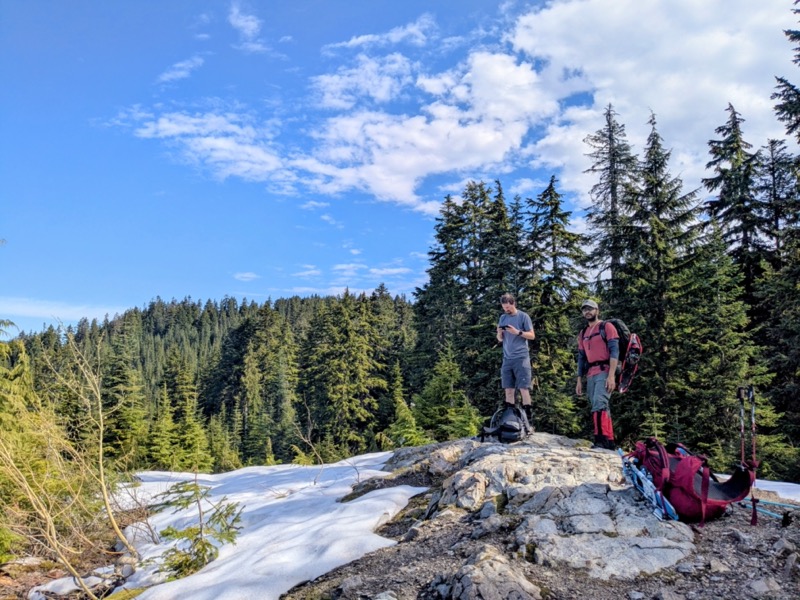
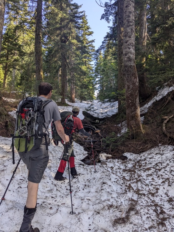
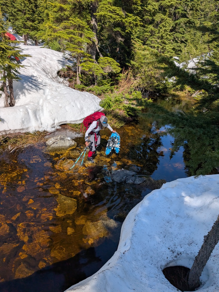
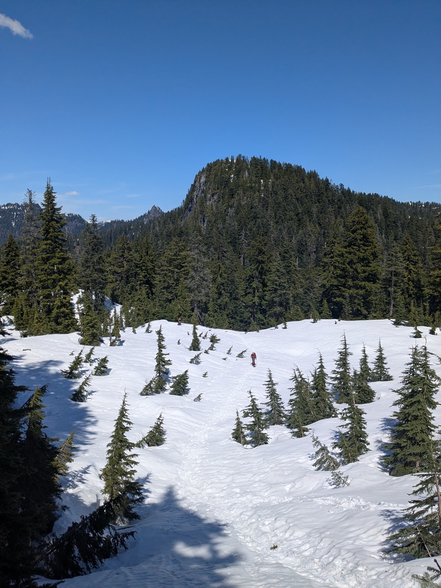
The snow was quite slushy and inconsistent – not deep enough for snowshoes and not firm enough for microspikes. The snow-covered logging road would continue for another 3 km before emerging onto the ridge. At one point, we decided to take an internal trail instead of the road, and quickly regretted the decision. This section, part of the Upper Village, passed by a few more cabins but was water-filled and boggy. We had to struggle to keep our feet dry in this part. 30 mins later, we were on the ridge, standing next to the remnants of the old ski lodge.
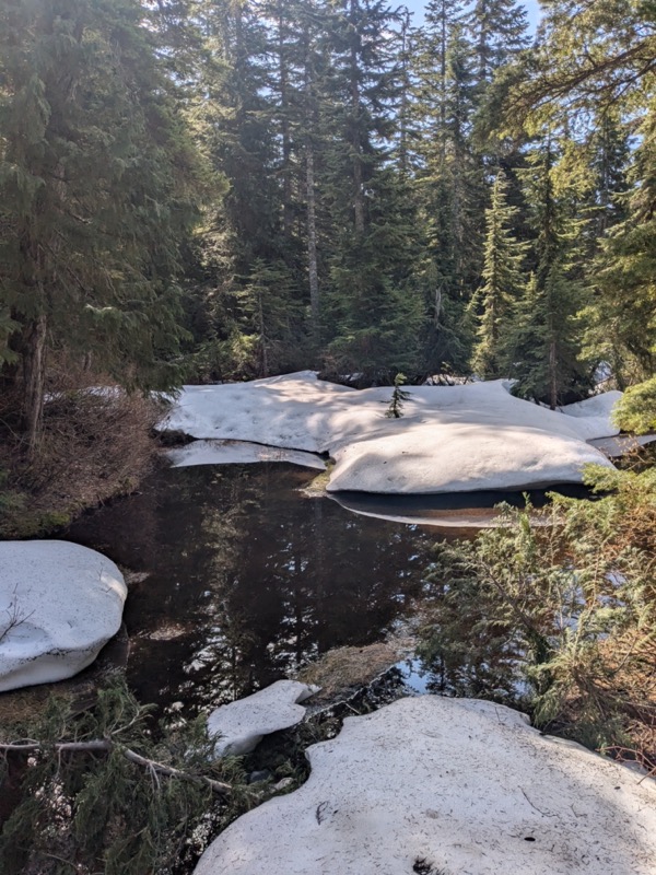
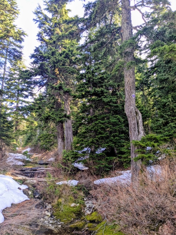
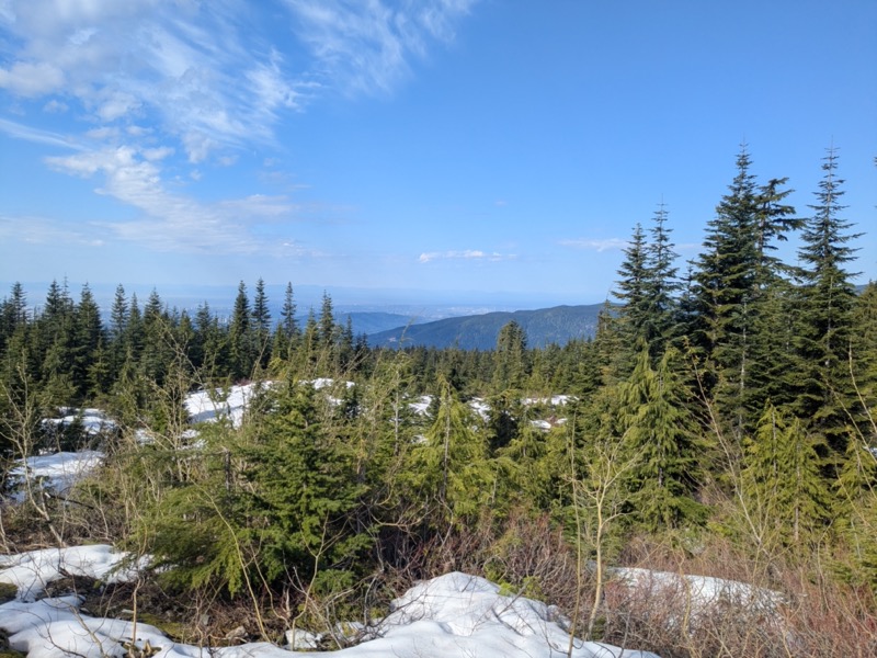
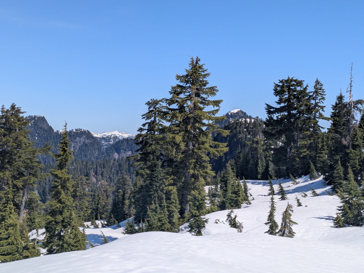
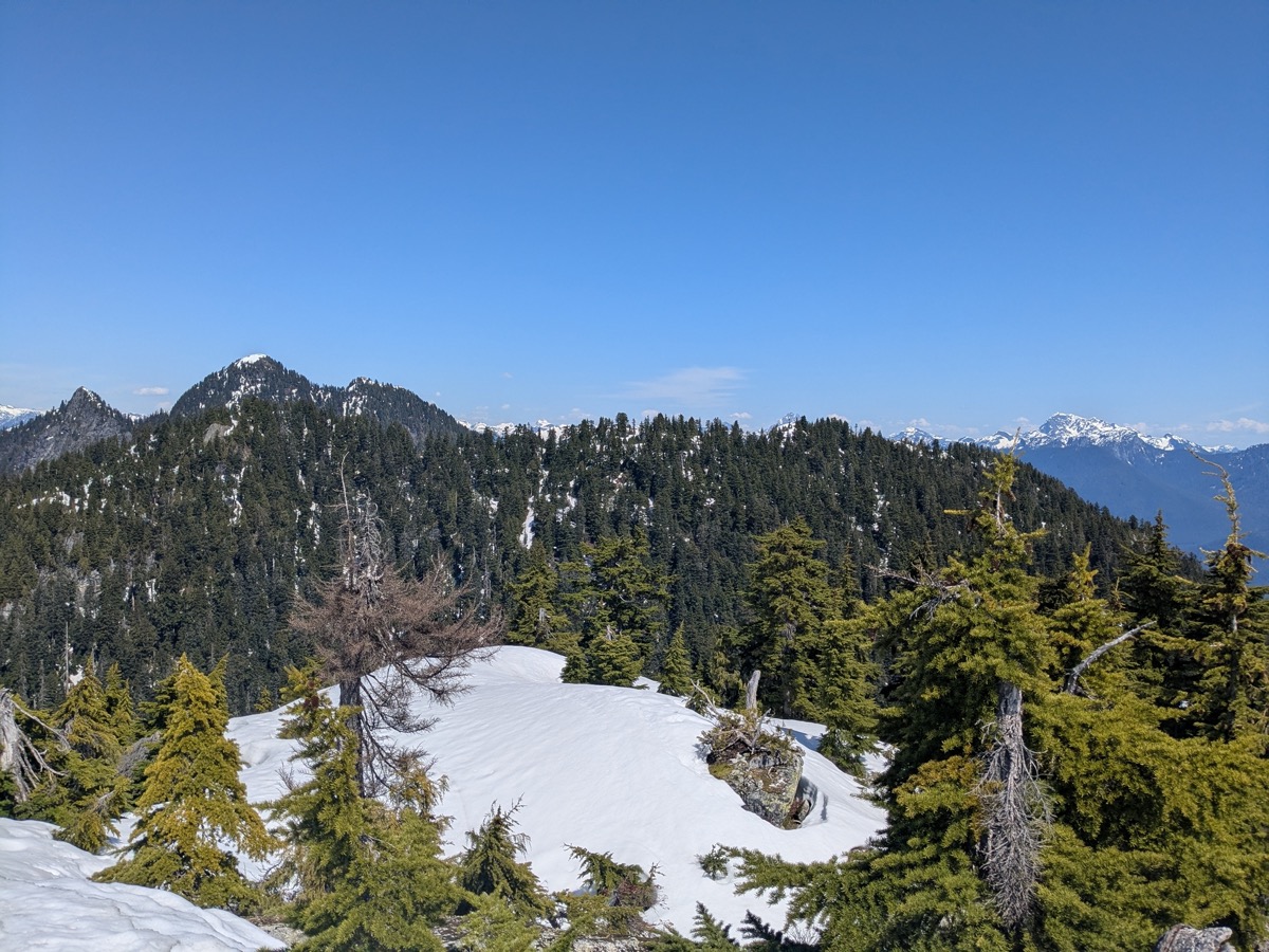
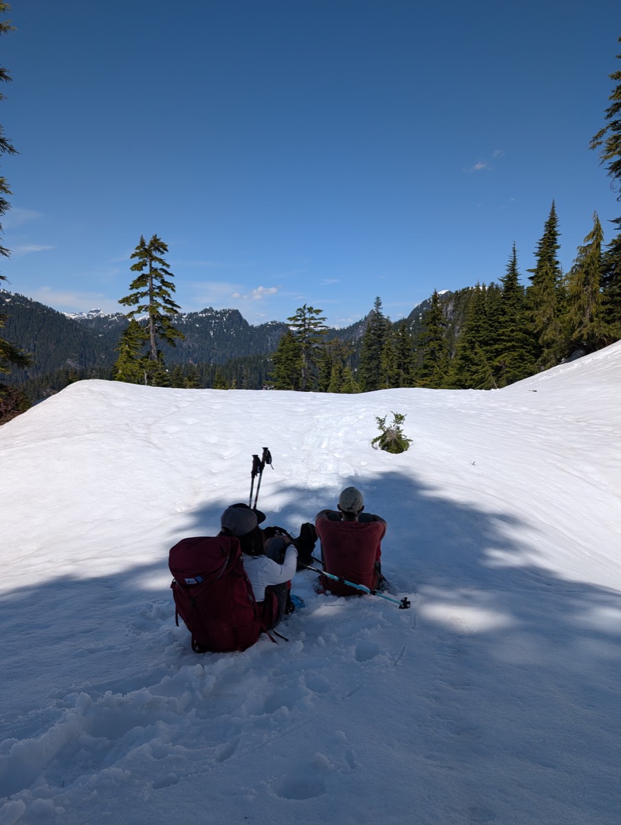
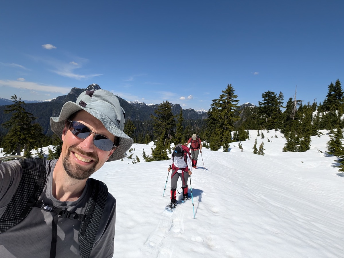
From here, we would stay on the ridge all the way to the summit without a significant direction change. After a short break, we started our long ridge walk. Burke ridge isn’t the kind of ridge that offers open views on the sides. It’s quite forested, and even though you are often under open sky, parts of the trail take you through the woods and across creeks.
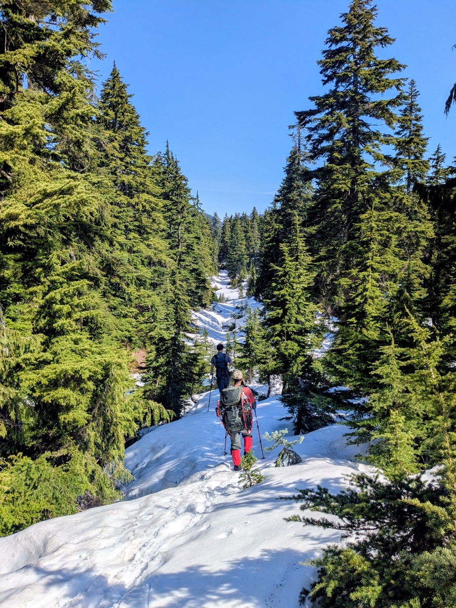
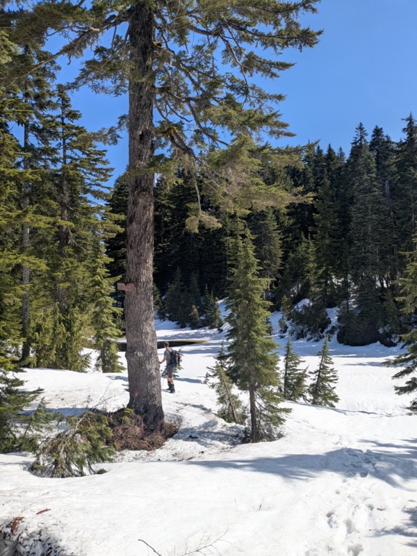
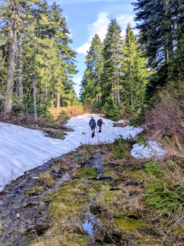
We started postholing quite a bit in this part. After watching Nathanael have an easier time on his snowshoes, Abhi and I followed in his lead, and the walking suddenly felt more efficient. For the next 4 km, we followed the Gaia trail as closely as possible, although often ending up in detours. We passed multiple lakes along the way, all of which were still frozen.
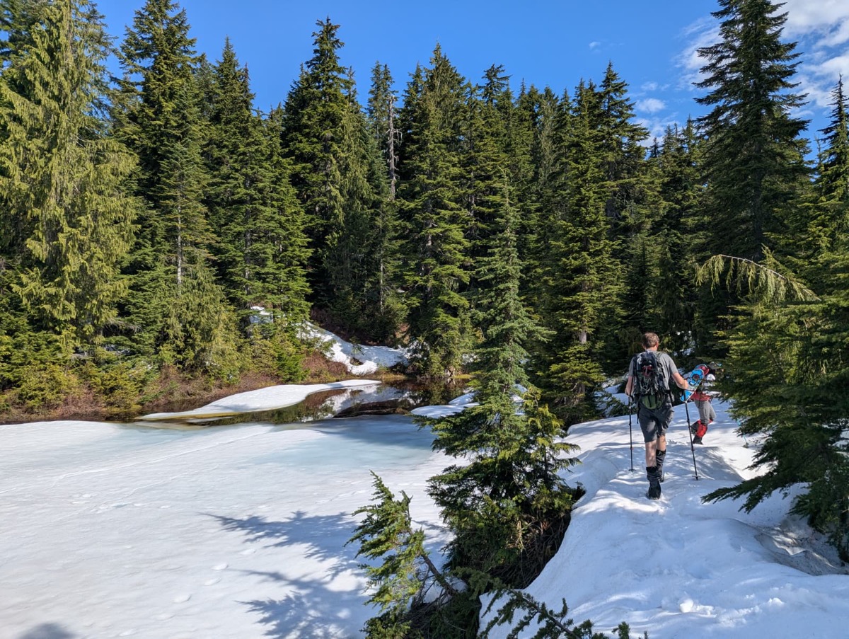
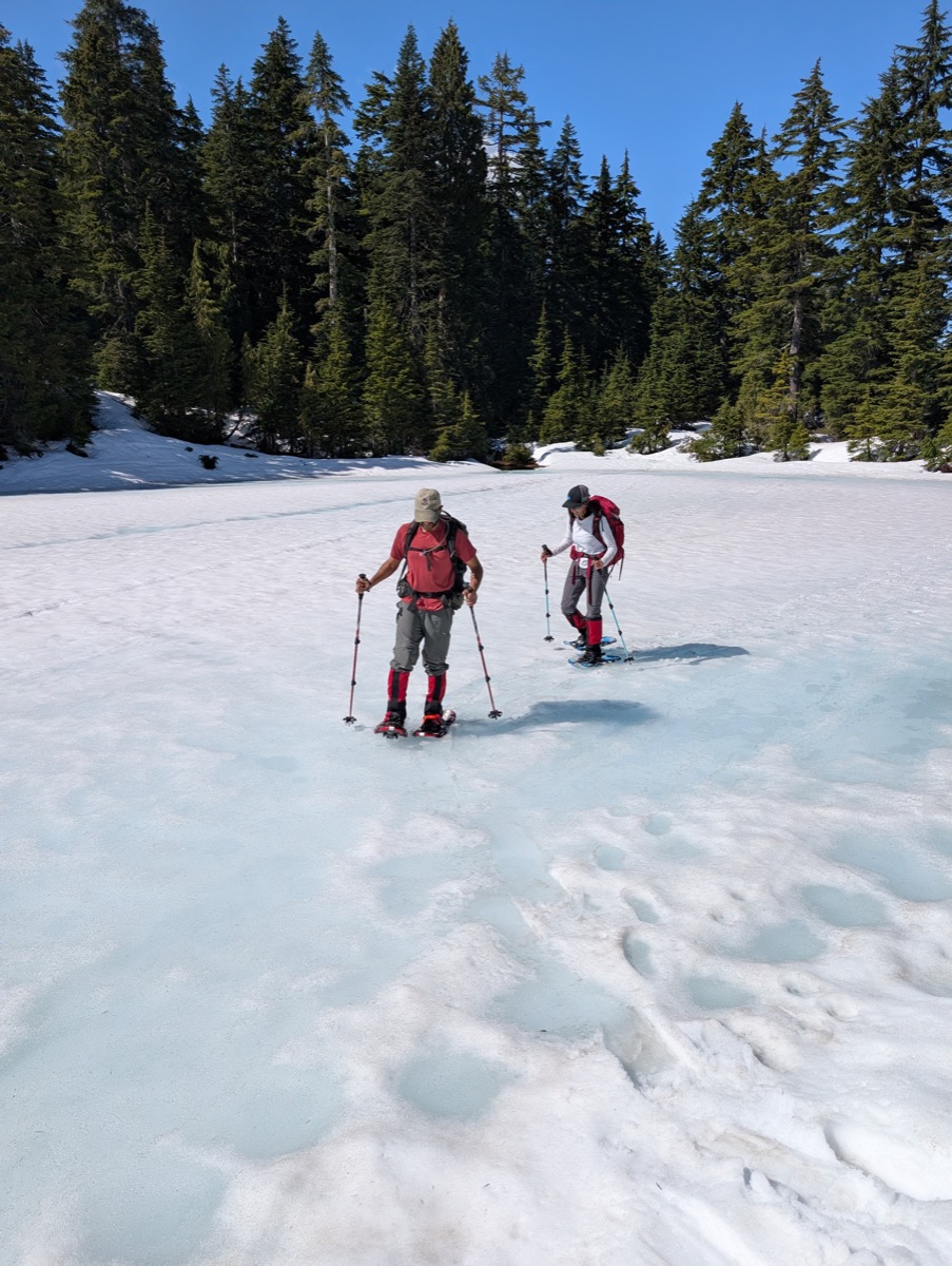
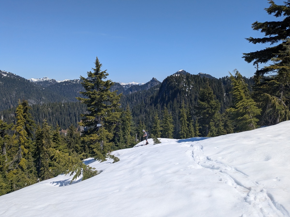
The creek crossings were not the easiest but we kept finding our way easily enough due to helpful trail markers on the trees. It was an enjoyable walk through snow, forest, and open ridge terrain. The elevation gain was gradual, as we had already driven up the steepest section the previous evening.
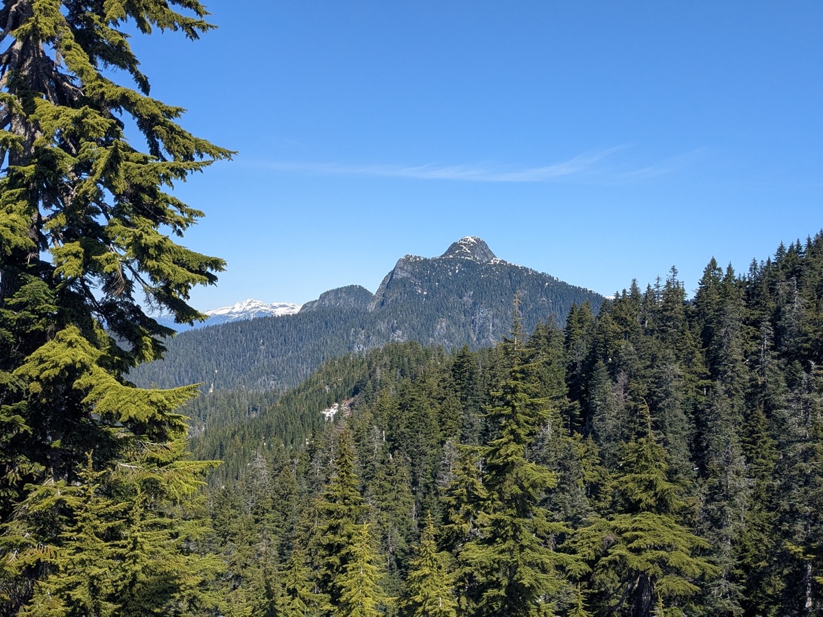
Coquitlam Mountain Overlook rewarded us with amazing views of Coquitlam mountain. It looked beautiful from this angle and I promptly added it to my wishlist. The scenery kept opening up as we continued, with more mountains coming into the view.
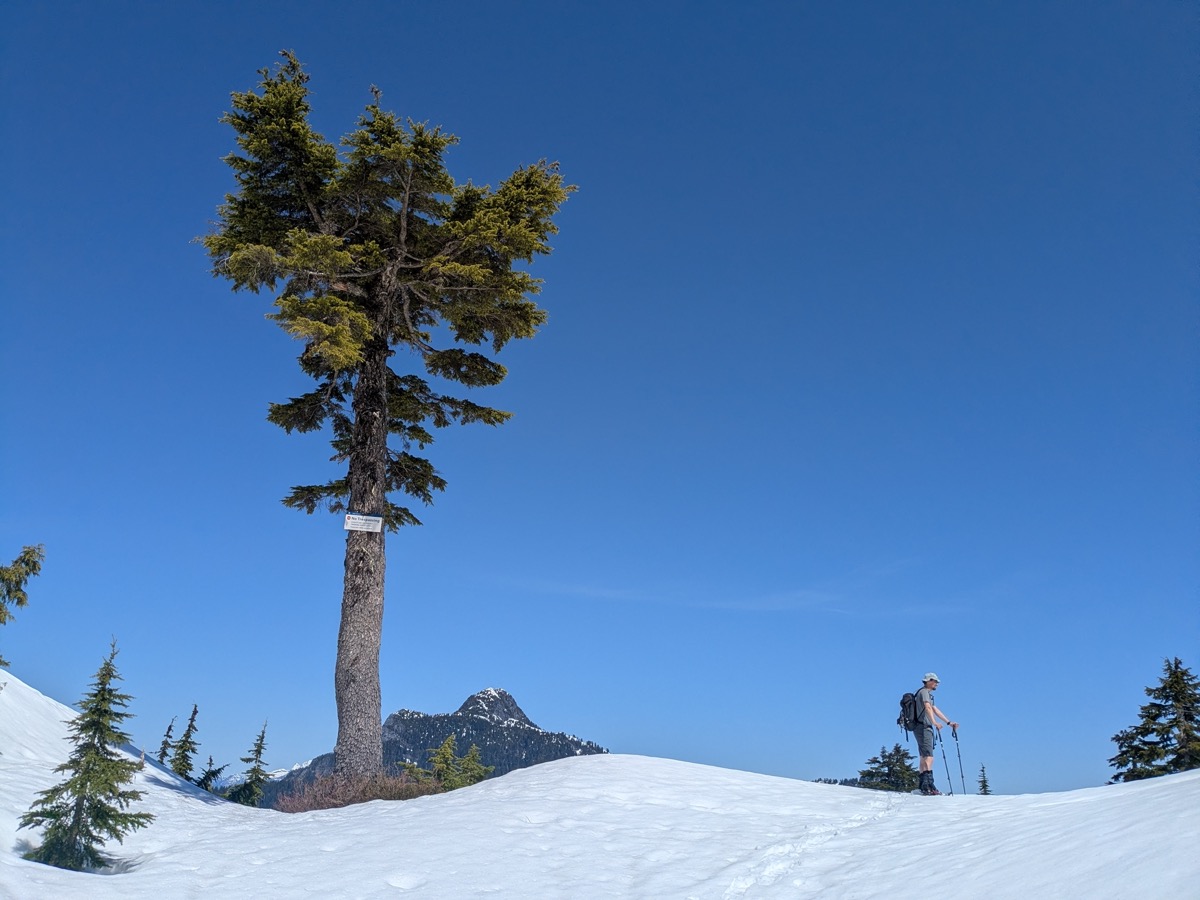
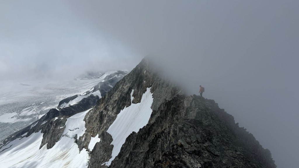
Around 11 am, we found ourselves on the bump called South Burke Summit. Blocked by trees, there are absolutely no views from this summit. From there, we descended into the saddle between South Burke Summit and Pika peak. Now only the summit block of Pika remained to be climbed.
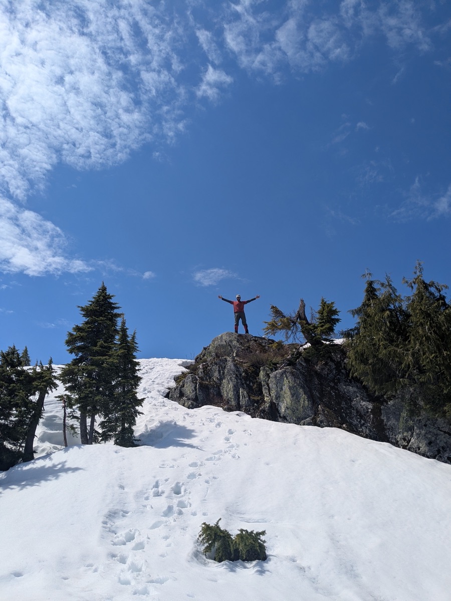
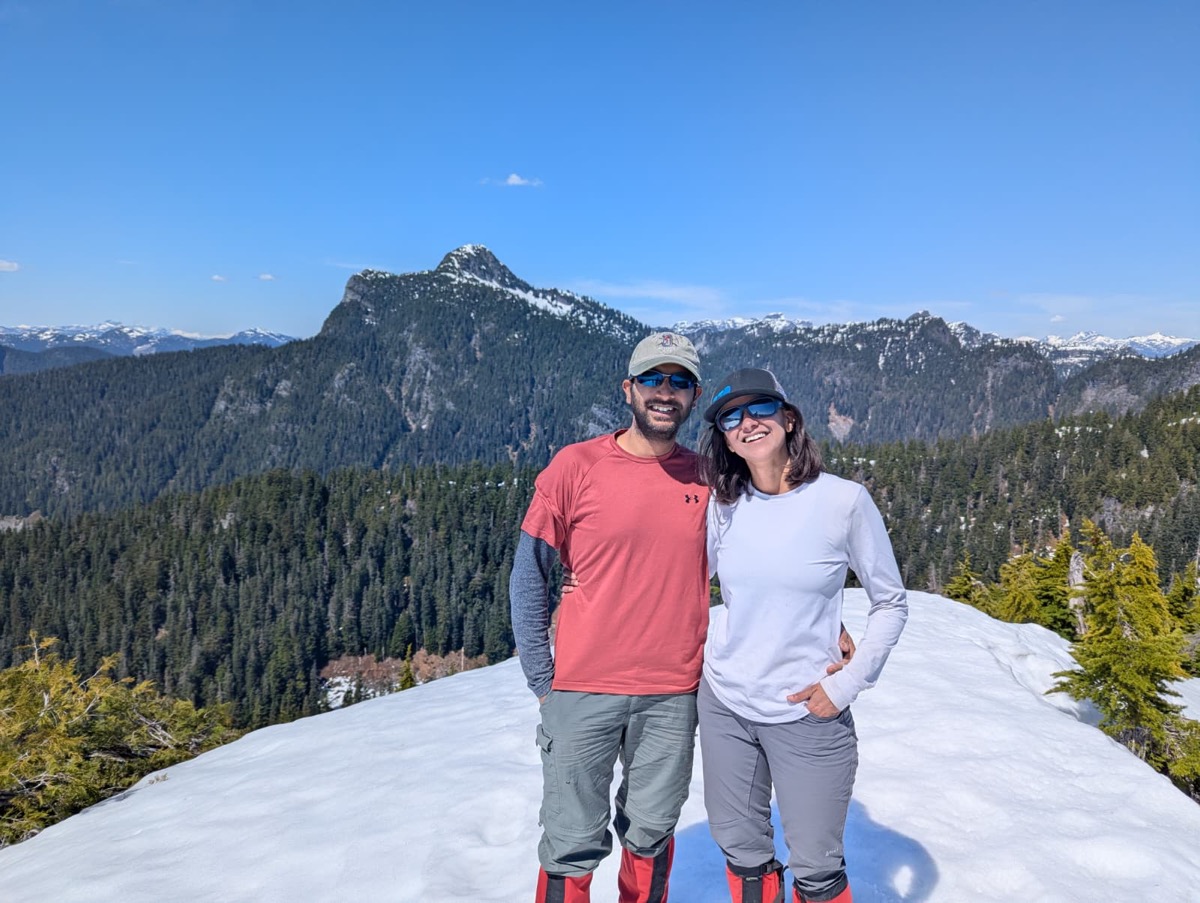
This turned out to be a bit more challenging than any of us had expected. The first half of the ascent was a bit bushwhacky, although not that bad. The second half became quite steep with tenuous snow cover. A couple of times, we got blocked by steep bluffs or unclimbable slopes. After scouting around and kicking purposeful steps with our microspiked boots, we finally found a feasible path not too far from the marked trail on Gaia. We emerged on the final flat section and walked up the last few meters to the summit around 1 pm, tired, but very happy with the reward awaiting us.
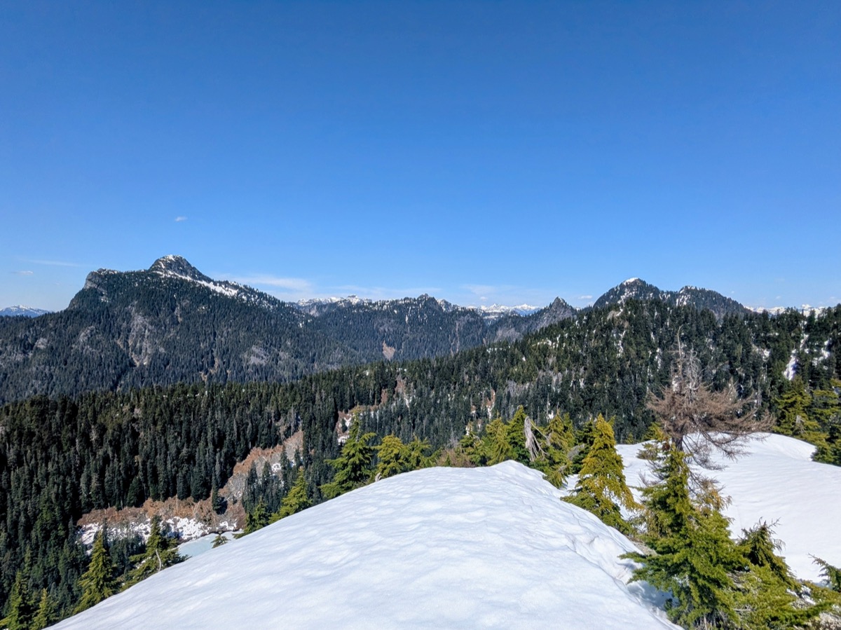
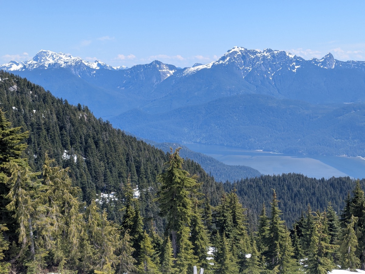
The views from Pika were outstanding. To the west, we had the North Shore mountains; to the north, Coquitlam Mountain, Widgeon peak, and North Burke Summit. The eastern horizon was outlined by Mount Robie Reid and the Golden Ears group. We lingered on the summit for quite some time, gorging on food and soaking up the sun-kissed views.
The descent felt long but uneventful. We simply retraced our bootpack. Nathanael was in the lead again, helping with navigation. It was three hours before we were back at the parked Jeep.
It was a great day in the mountains, and I was happy to finally experience a part of Burke I hadn’t seen before.


Leave a comment