
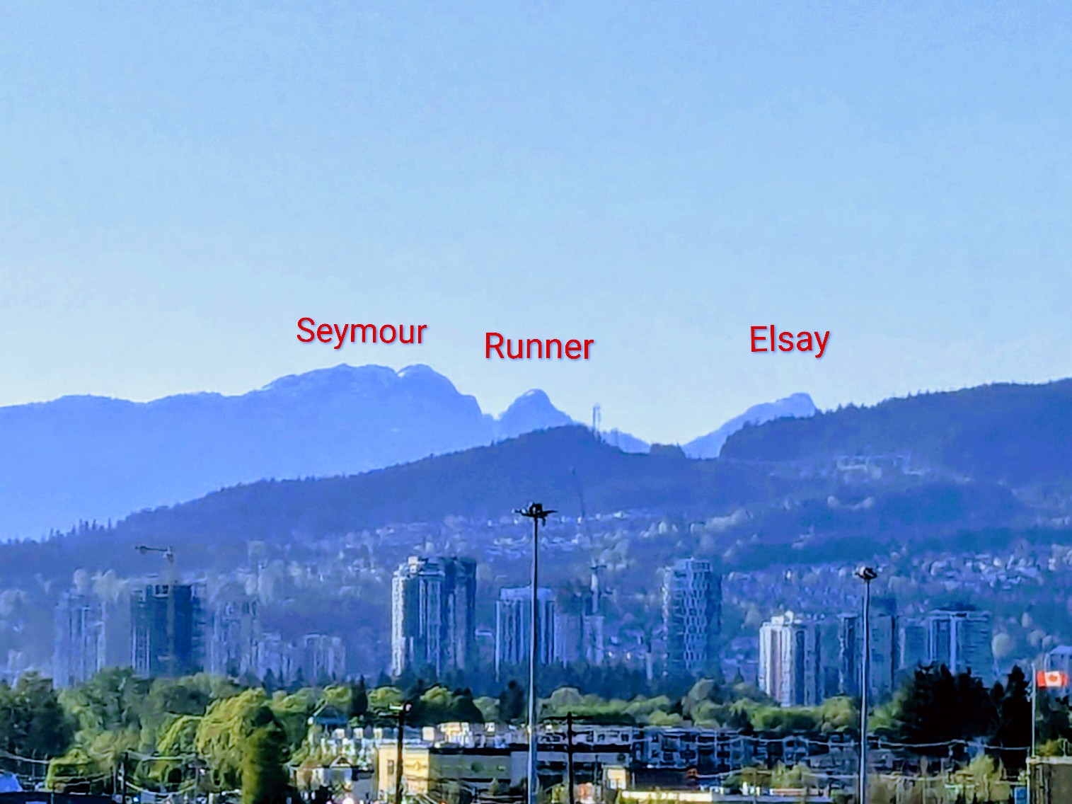
If you turn your gaze toward the North Shore mountains while driving on Highway 1, you’ll notice a series of peaks forming the Fannin range of mountains behind Mt. Seymour ski resort. The first three peaks, Pump, Tim Jones, and Mount Seymour, look rather unremarkable. However, I have always been drawn towards the next two peaks in that series, the dome shaped bump of Runner peak and the triangle-shaped Elsay peak. After hiking up to Mount Seymour a few years ago, Runner peak naturally came on to my radar.
While Runner can be done as a summer hike, I was more interested in going there under snow cover, especially after reading Shashi’s trip report. Karolina and I set off for the peak on a sunny spring day.
Trip Stats
- Location: Runner peak, Fanning Range, Metro Vancouver area
- Date: April 26, 2026
- Trailhead to Trailhead Time & Distance: 9 hours, 13.03km
- Route: Traversing around the west side of Mount Seymour-back the same way
- Gear: Avy gear, microspikes, ice axe, crampons, helmet (we didn’t carry snowshoes)
- Things to note: During November to April, the Mount Seymour Road is closed between 10pm and 7am daily. Plan your start times accordingly.
Up to Tim Jones Peak
We met up at the parking lot at 7:30 and were on our way to Tim Jones by 7:45. The snow cover at the trailhead was extremely thin and we wondered what was in the store for us as the day progressed.
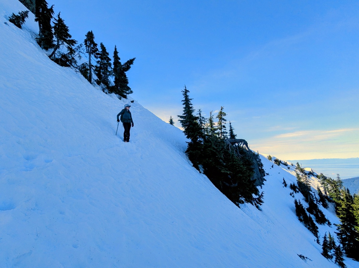
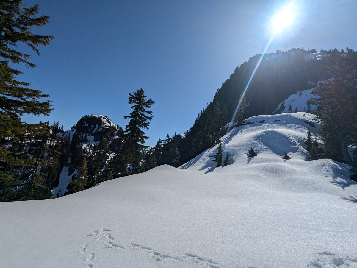
We arrived at Pump peak after about 75 mins. The microspikes kept us comfortable on the popular boot pack. Due to the extremely low snowfall this winter, the summit block was completely free of snow. We skipped going to the top and kept walking towards Tim Jones. The snow was still crisp to walk on at this point.
We were on the summit of Tim Jones after another 15 mins. From there, it was time to traverse around its west side to get to the col between Tim Jones and Mount Seymour.
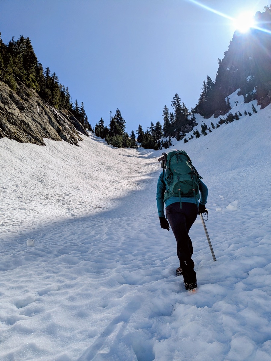
The traverse presented no issues as the snow was soft and there was an existing boot pack on it. We still wore our crampons and took the ice axe out for safety, and were at the col in no time.
Tim Jones to Runner
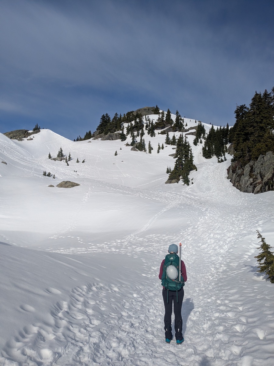
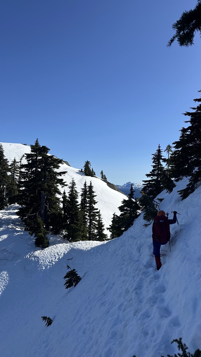
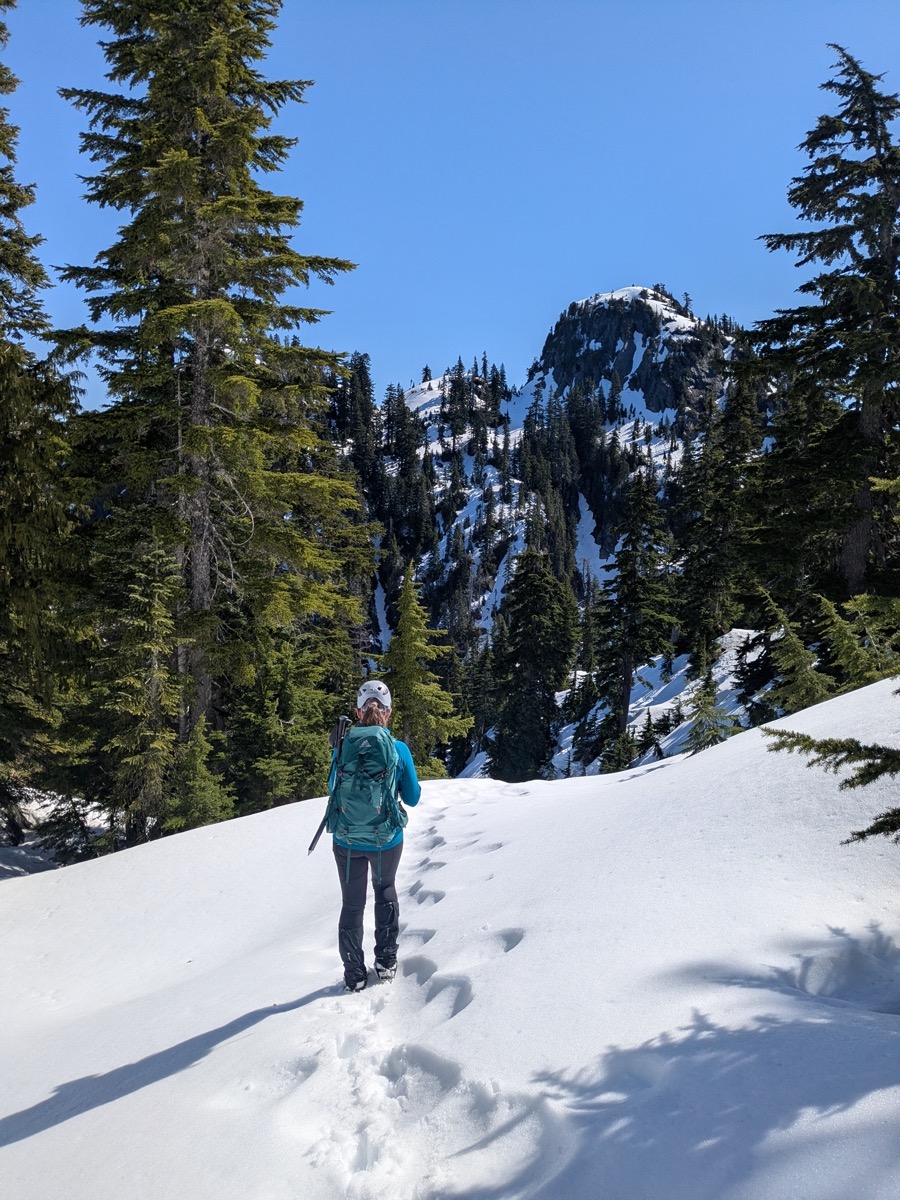
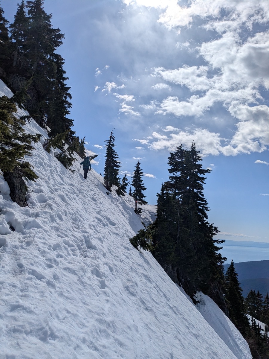
From the col, the route towards Runner drops down a gully to the west. The gully was wide enough that we had to spend a few minutes deciding whether to stay closer to the left or right side of it. There were no other boot tracks from this point onwards – just us.
The left side looked more straightforward but would have put us a bit away from the GPX track we were using for reference. Since we’d also eventually need traverse to the right (around the west side of Mount Seymour), we stuck to skier’s right and started descending.
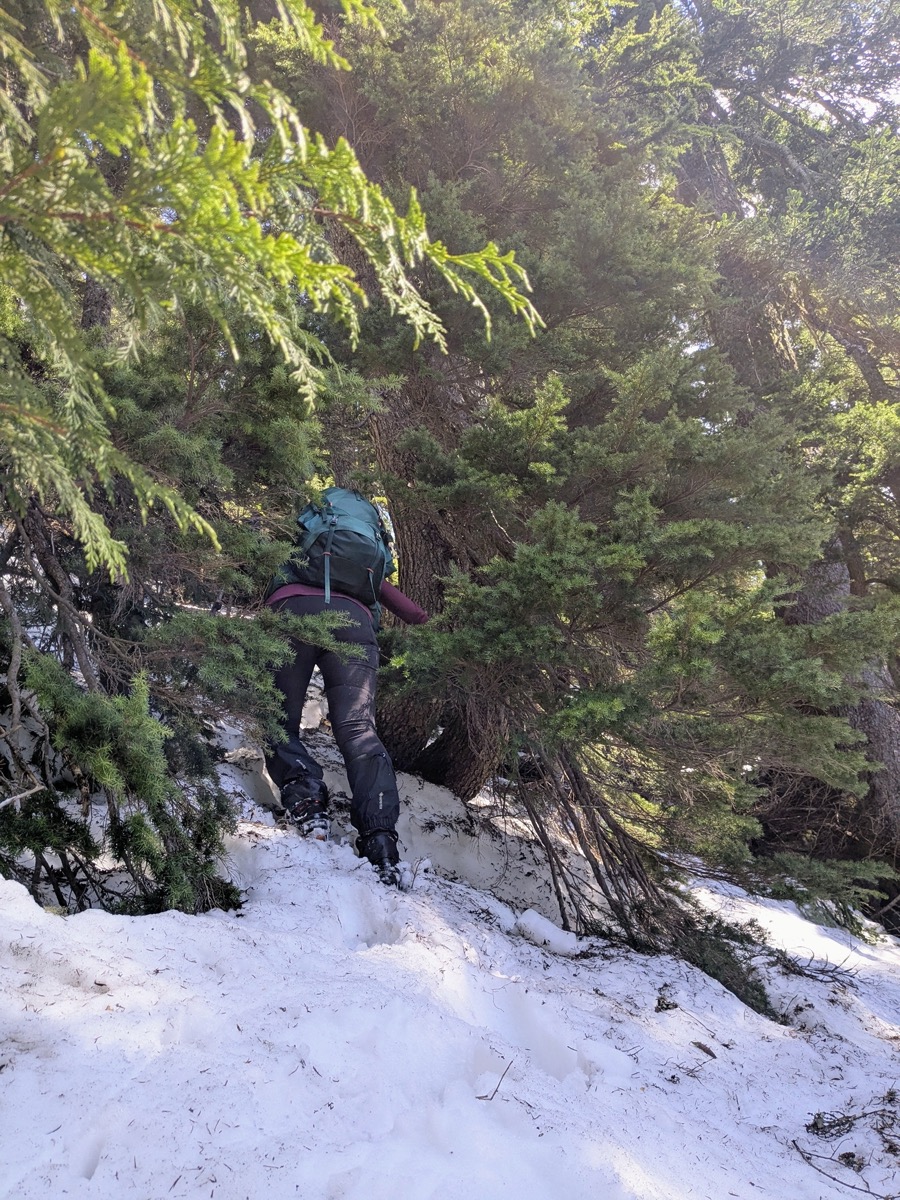
Within just 100m of going down, we hit terrain that was forested and a bit bushwhacky. Having the GPX track was really helpful here. While we knew the general direction of the approach towards Runner, the track helped us stay on the right contour lines for the most efficient path.
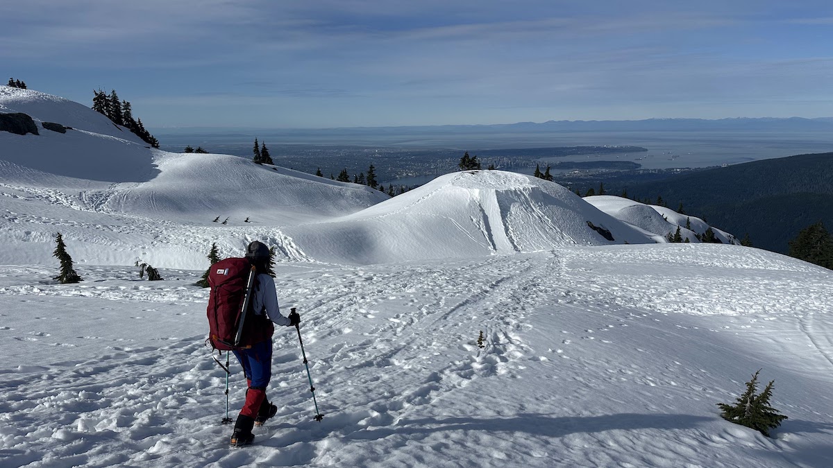
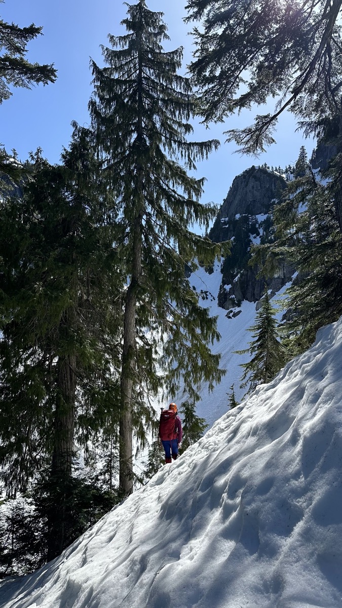
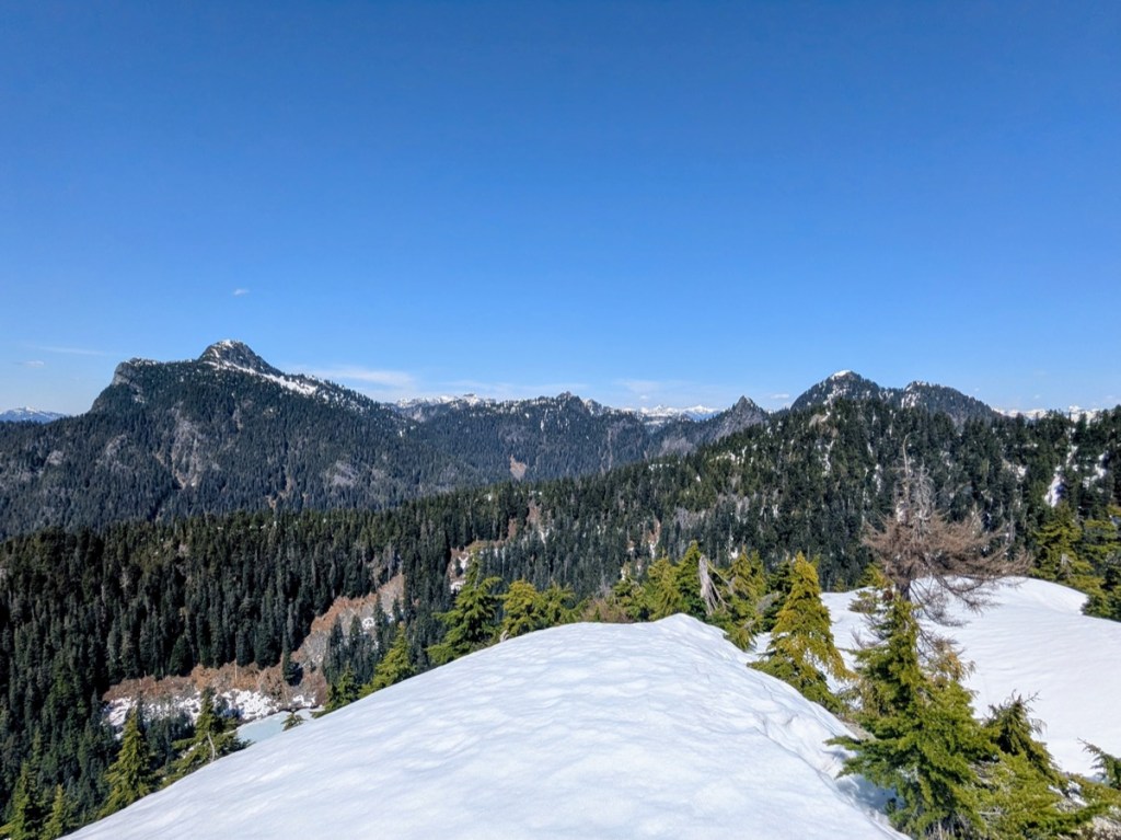
After about 200m of downhill, we traversed around Mount Seymour and the forest cover got denser. We kept following the gpx track as best as we could and, after a short uphill section, reached a bump on the west side of Seymour. From here, we had our first view of Runner peak and that felt good!
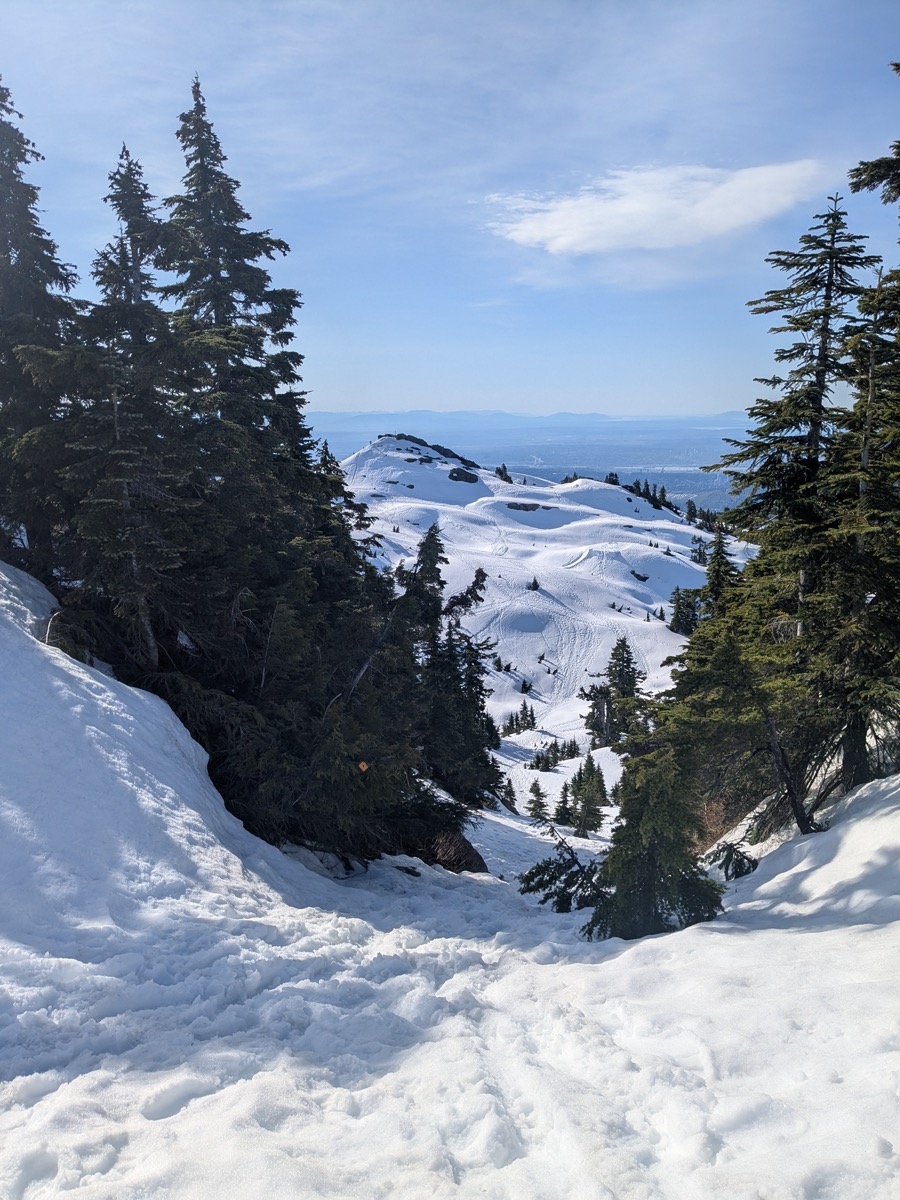
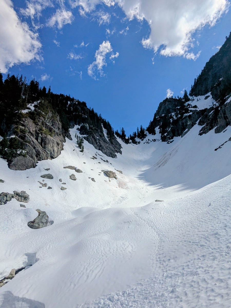
The trail was easier to follow after this point as we started spotting ribbons and the forest thinned out somewhat. Another 30ish mins of downhill brought us in the snow bowl at the base of the gully leading to the top of Runner peak. Throughout this traverse, I was glad we had left the snowshoes in the car as they would have just stayed in the pack during the bushwhack.
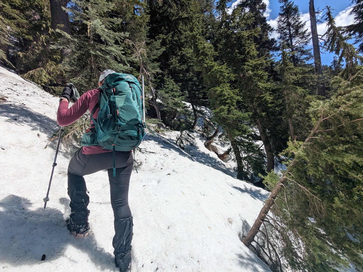
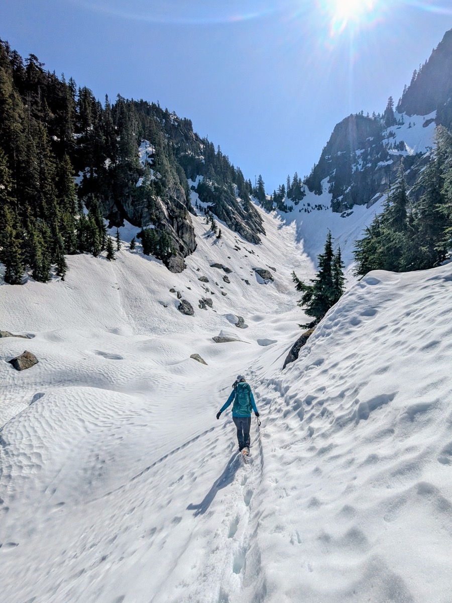
Relatively speaking, the final gully turned out to be the hardest part of the hike. The snow had turned really slushy by this time (11 am). Without snowshoes, we had no option but to slowly trudge towards the top, postholing constantly. It was tiring work and Karolina and I took turns breaking trail.
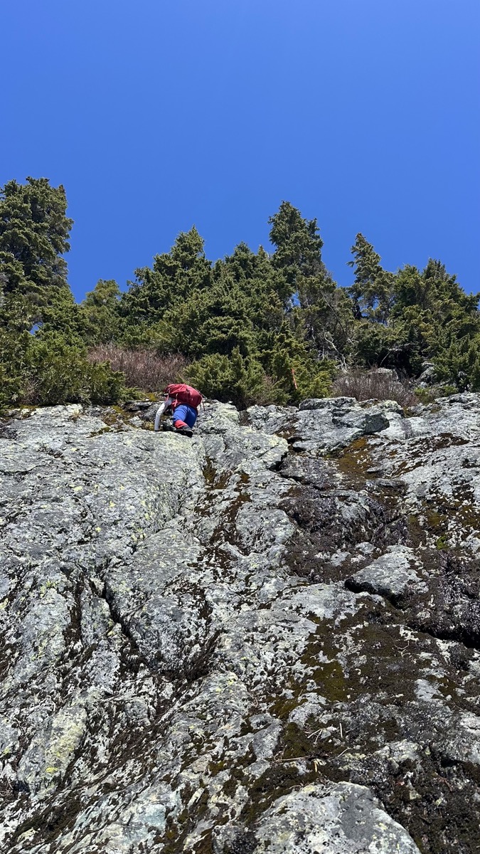
3/4th of the way up, we decided to cut through the trees to our right and arrived at the col between Seymour and Runner. This part of the mountain was filled with boulders embedded in the snow. The surrounding snowpack felt tenuous. So we went back to the trees and found a safer way to reach the summit wall.
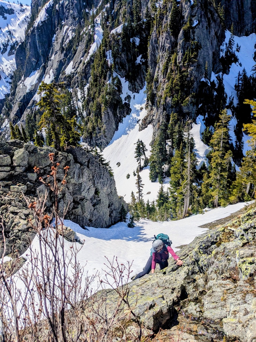
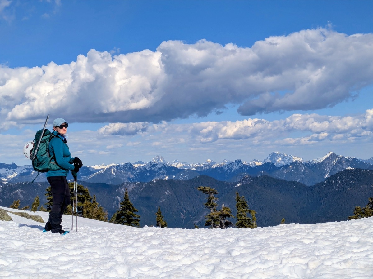
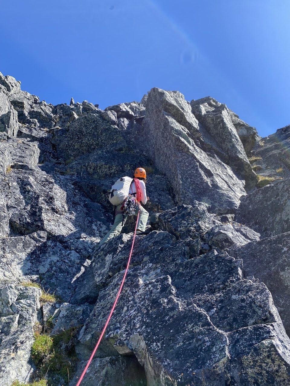
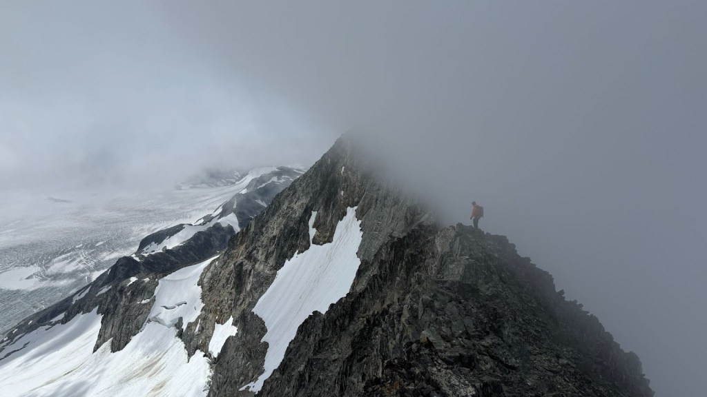
A surprise awaited us here. We had expected the summit wall to be snow covered , but it was completely snow-free. This meant class 3 scramble in our big hiking/mountaineering boots. The scramble looked mellow, so we chalked out the easiest path and got moving. The scramble up was easy enough and added a fun element to the day’s experience. All that remained was a few more meters of scrambling and snow. We did that together and summited at 12:20pm!

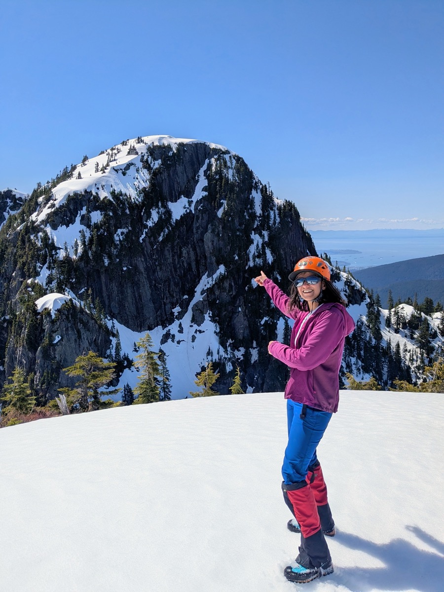
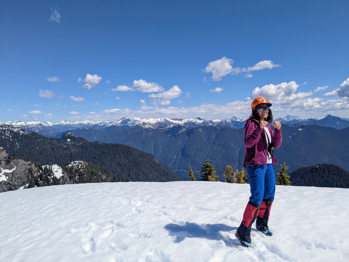
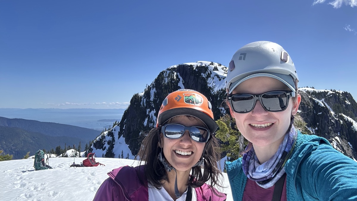
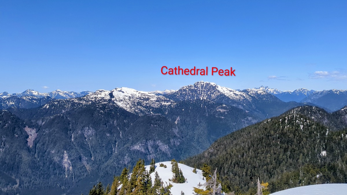
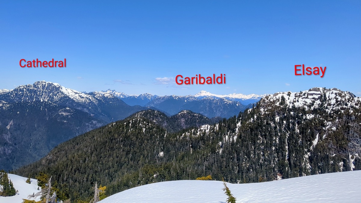
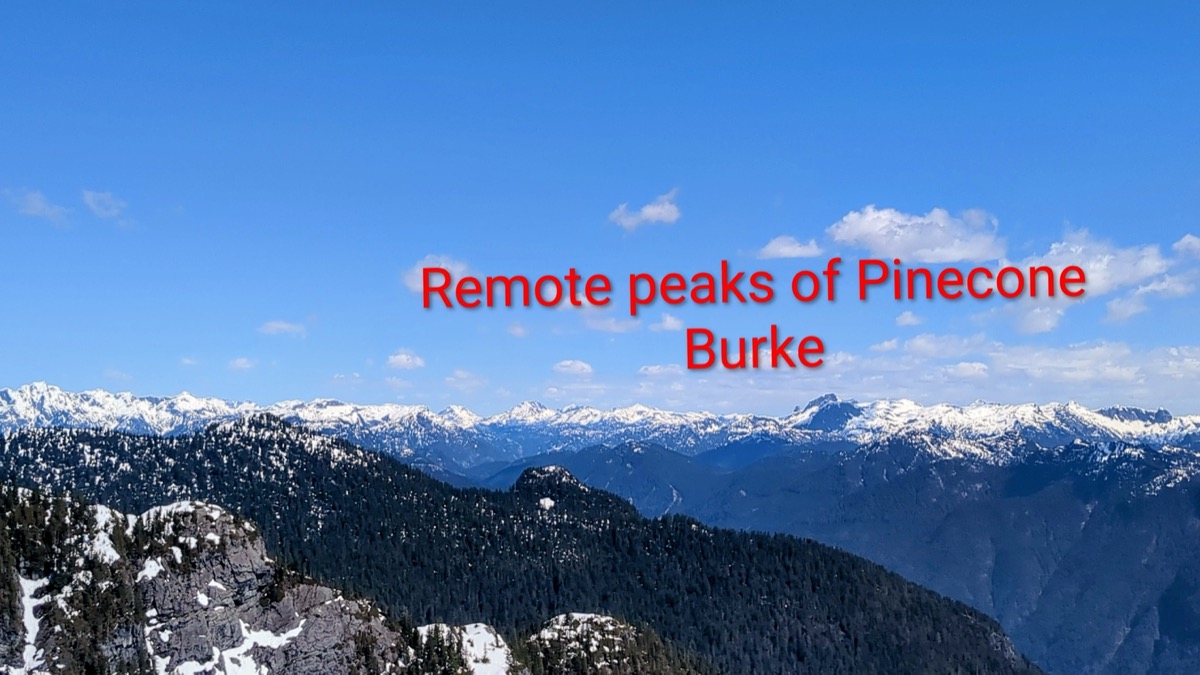
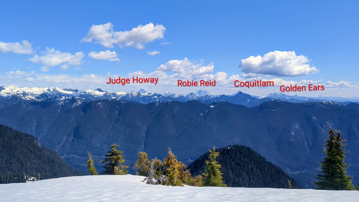
The summit rewarded us with stunning 360 degree views of the North Shore Mountains, Sky Pilot group, Garibaldi/Atwell, the Five Fingers group of Pinecone Burke, and the Golden Ears range. We took our time refueling, soaking in the views, and getting some rest. After clicking a few fun pictures, we started our descent around 1 pm.
Return
It would be incorrect to call the return journey a “descent”. After carefully scrambling down the summit block (where I decided to go bare feet and not worry about my stiff boots), we retraced our steps through a series of unending ups and downs. The track we had made on the way in helped us but by this time, we were taking more frequent energy breaks. So taking our time and now enjoying the views with a relaxed mind, we came back to the parking lot around 5pm.
It was a full-value adventure with Karolina as a solid mountain partner. We had spent the day chatting through the slog, navigating together, sharing trail-breaking effort, and keeping the stoke high. We parted ways only after deciding to plan more such trips in the near future!

Leave a comment