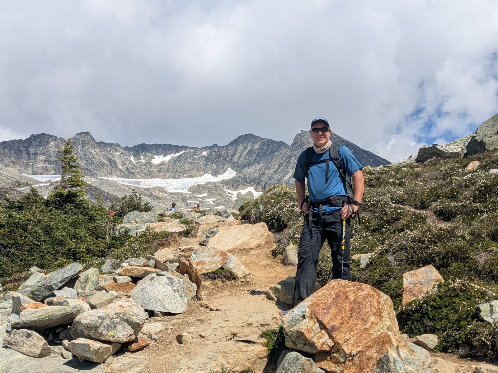
Hike upto Wedgemount Lake Campsite
On a warm, late-July day, Neil, Suhrud and I walked up the forested slopes of Wedgemount Lake trail. We were grateful for the cool shade offered by the old-growth forest, though it wasn’t long before the bugs found us. The approach was steady and uneventful, with our conversations wandering between summer plans, our lives, and pros and cons of DEET bug sprays. Along the way, we met a party of two that was coming down after climbing Wedge Mountain. One of them described the terrible snow conditions they had encountered – but pushed on nonetheless. Later that day, a single glance at the snowless arete of the mountain confirmed their story -it looked brutal.
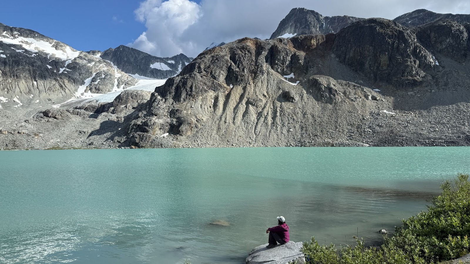
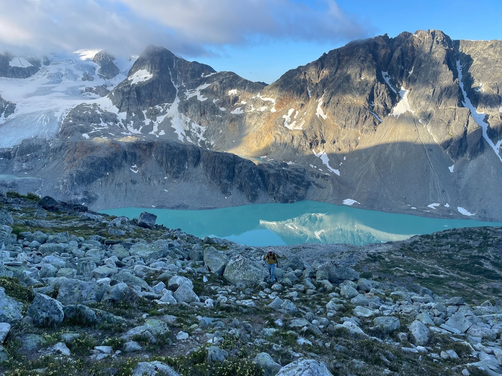
Wedgemount Lake
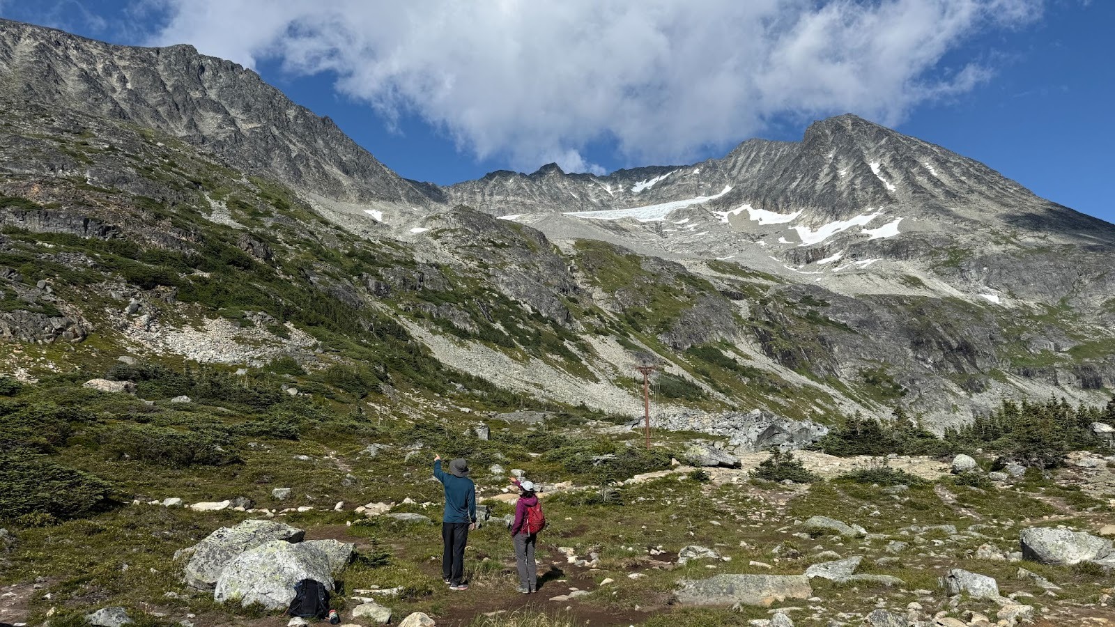
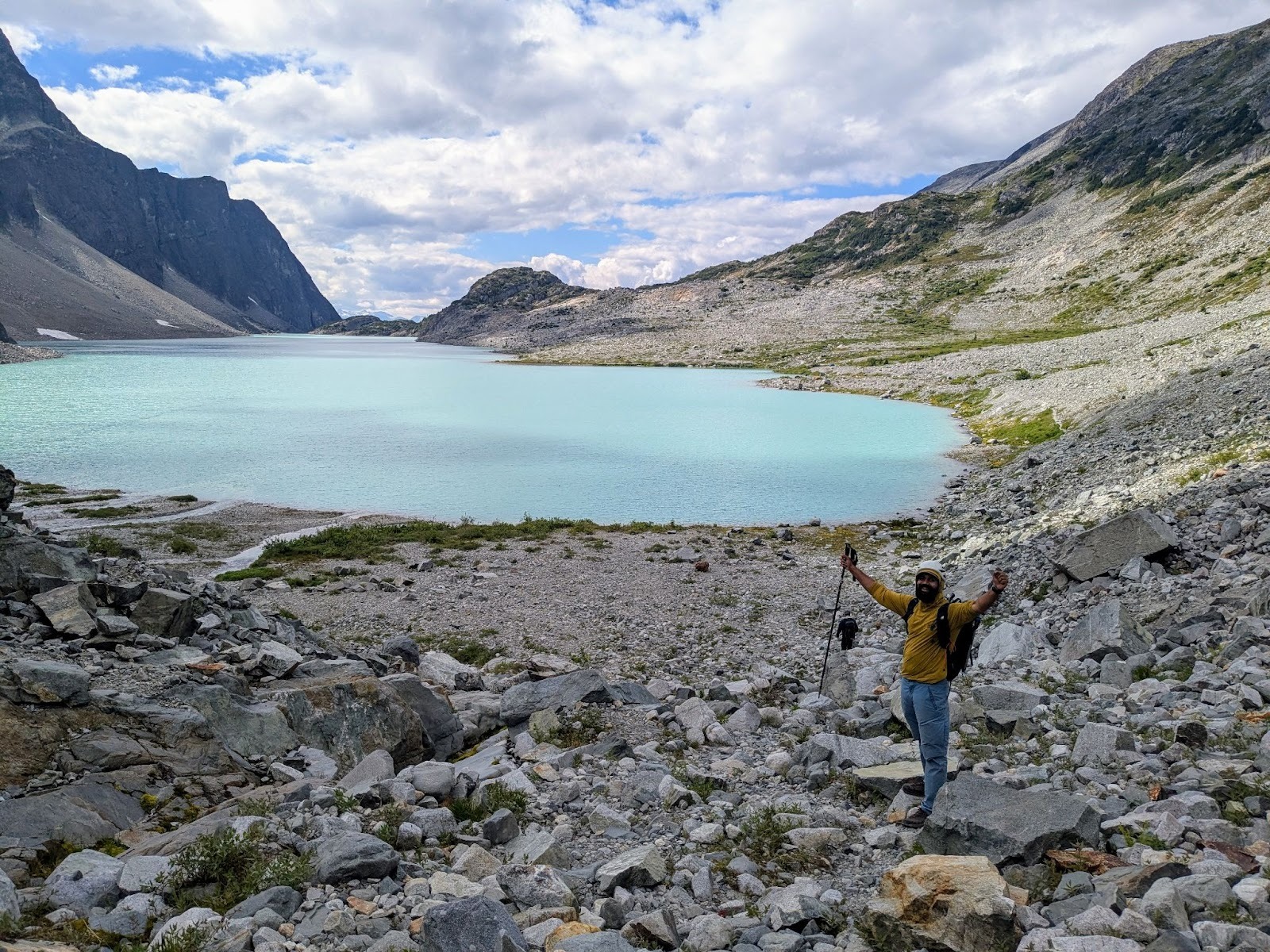
It was early afternoon when Wedgemount Lake greeted us in all its alpine glory – its turquoise waters gleaming under the summer sun. Across the lake to the north, our objectives for the next day – Mount Cook, Mount Weart, and the ridge connecting them – stood tall and cloud-free..
We chose to pitch our tents closer to the hut, hoping to shave off a little time from the next day’s long climb. By around 6 or 7 pm, clouds began rolling into the upper reaches of the valley, completely engulfing the Armchair Traverse. We exchanged uneasy glances, somewhat unsure how much faith to place in the “clear” weather forecast. With a silent prayer to the mountain gods, we set our alarm for 5:45 am and crawled inside our tents.
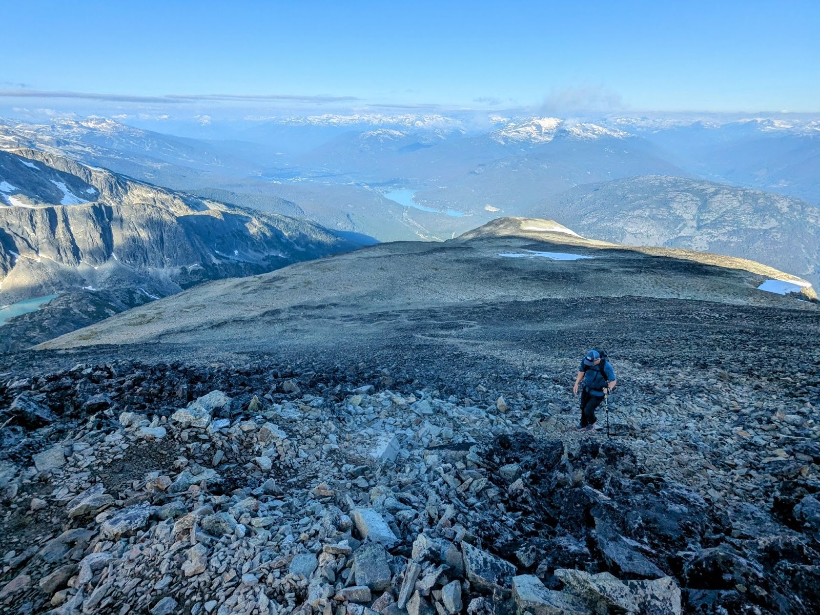
Mount Cook
We started hiking up Mount Cook at 6:45 am the next morning. The clouds still lingered in the valley, though there was no sign of precipitation. Hoping the sky would clear as the day unfolded, we pressed on. The hike was a steady slog, but relatively straightforward. Cairns marked the way – first leading us through patches of heather on a faint trail, and then up a series of switchbacks over scree and talus-covered slopes. As we reached the summit of Cook, grey clouds continued to swirl around us, limiting visibility to about 30 feet. However, we decided to carry on and reassess at the point where the terrain and navigation would become more technical. It had taken us 2 hours and 15 minutes to summit from the campsite.
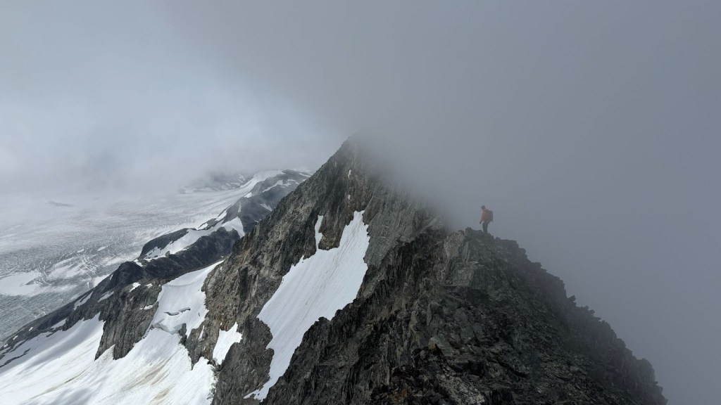
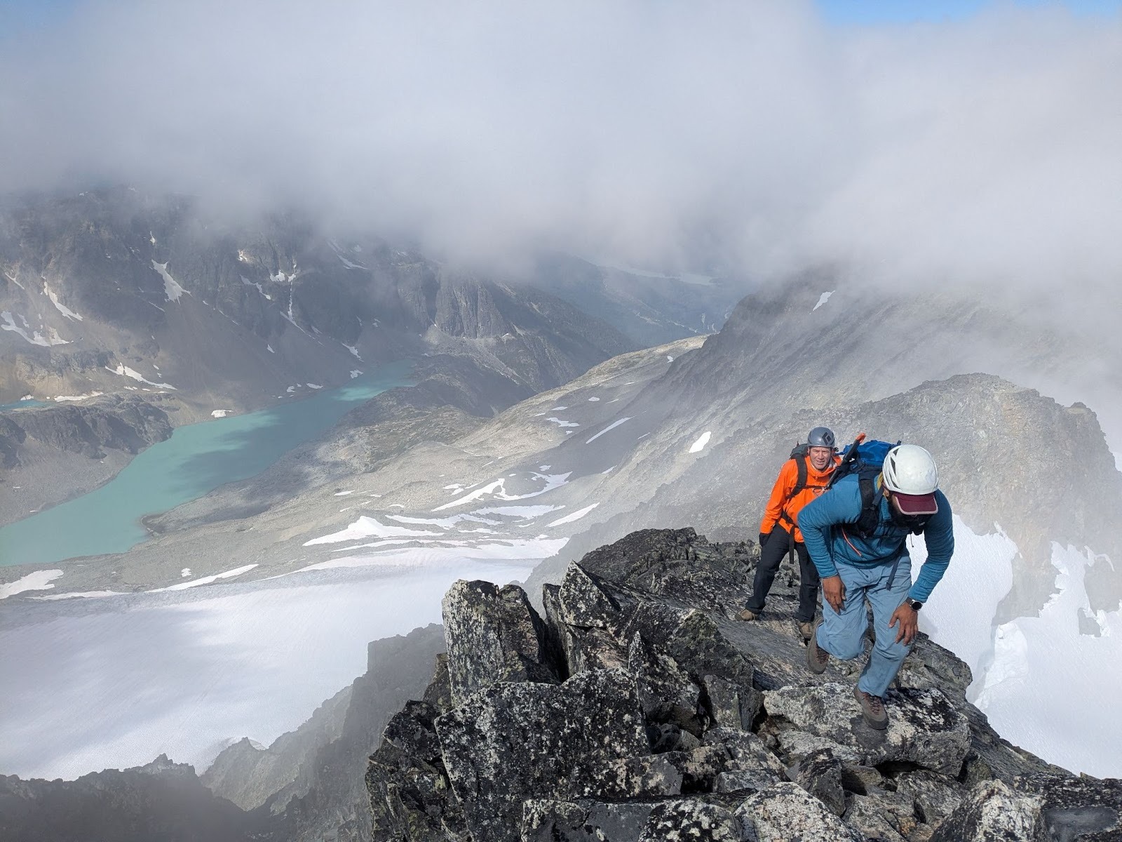
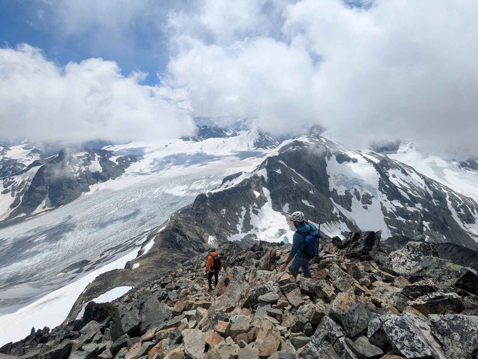
The Traverse
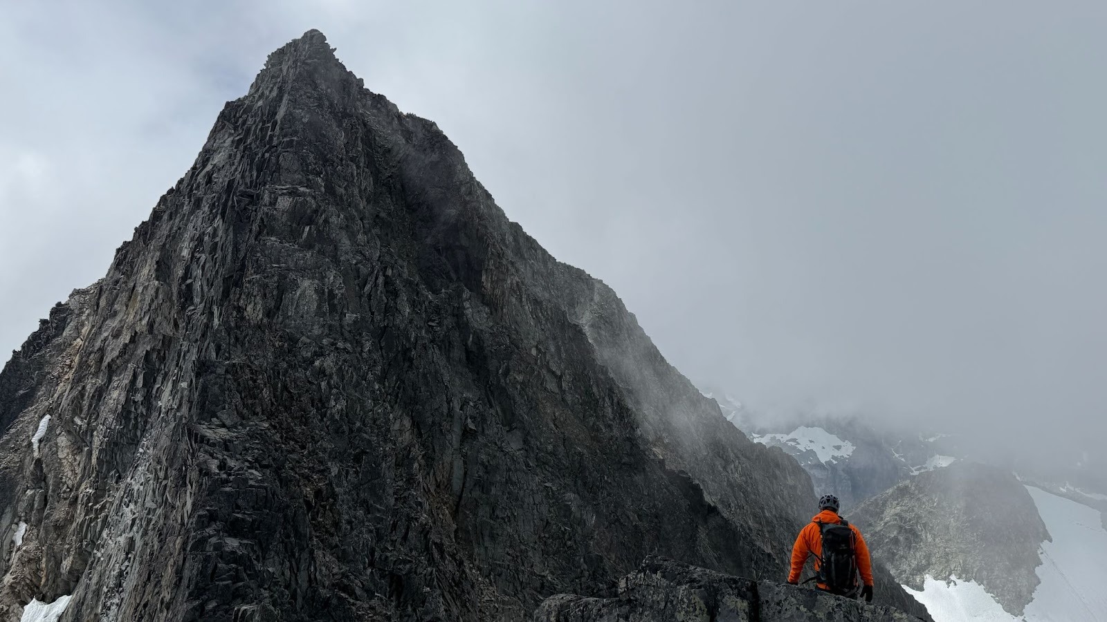
The scramble began shortly after we left the summit of Mount Cook. The visibility was good enough for navigation but anything beyond the immediate vicinity was washed out by the clouds – a condition that would persist for most of the traverse. Fortunately, the route more or less follows the ridge connecting the two peaks, so navigation primarily involved choosing the safest line forward.
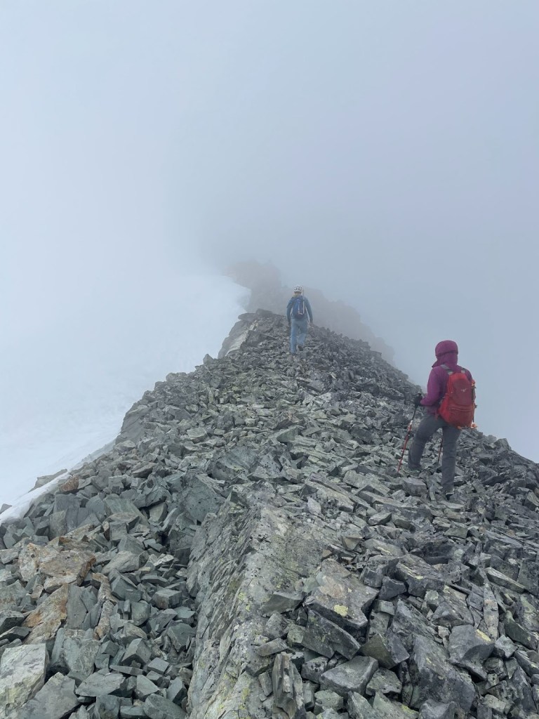
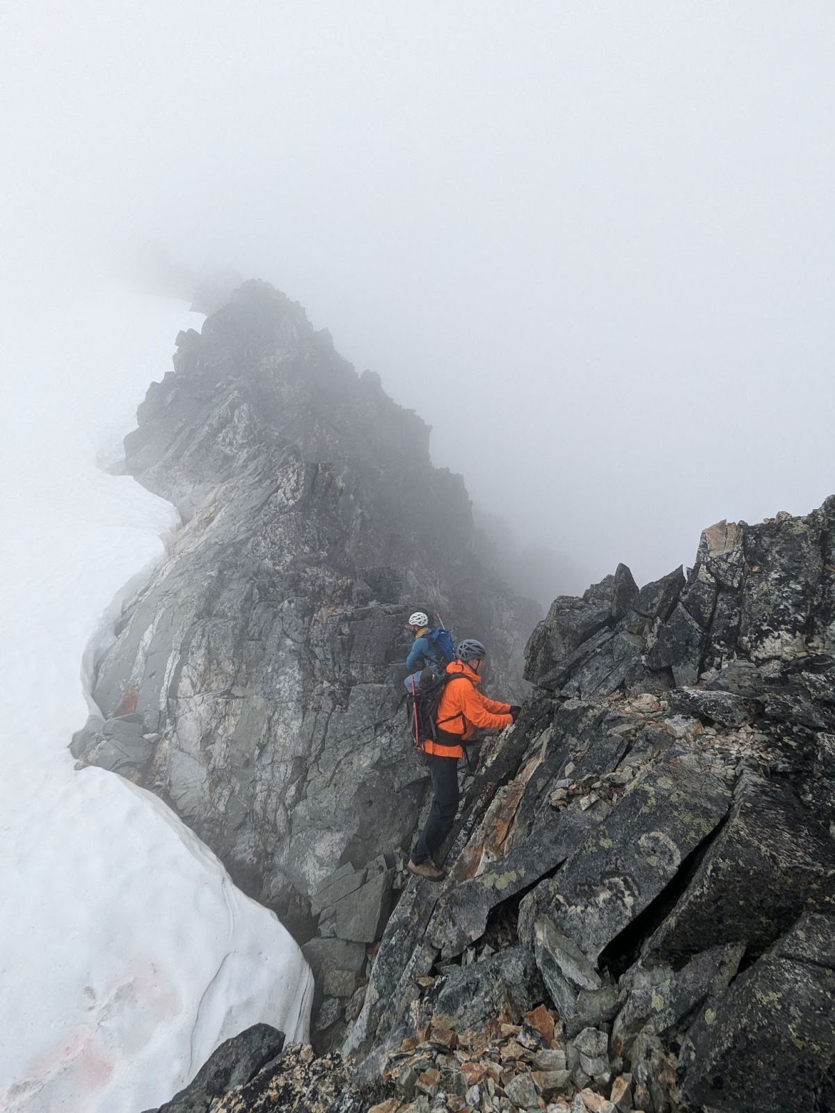
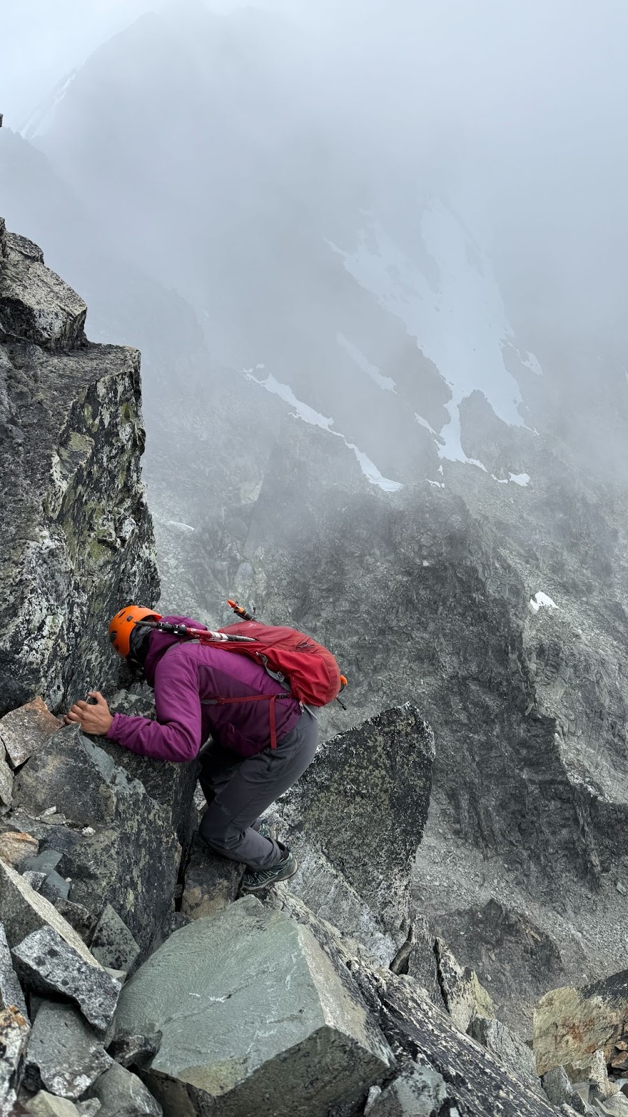
We often found ourselves balancing between two options: more exposed sections on relatively solid rock near the center of the ridge, or less exposed paths that were a chaotic mix of loose rock and talus. While we generally preferred the exposed but stable ridge crest, we occasionally dipped into side gullies and ramps when they offered a more reasonable alternative.
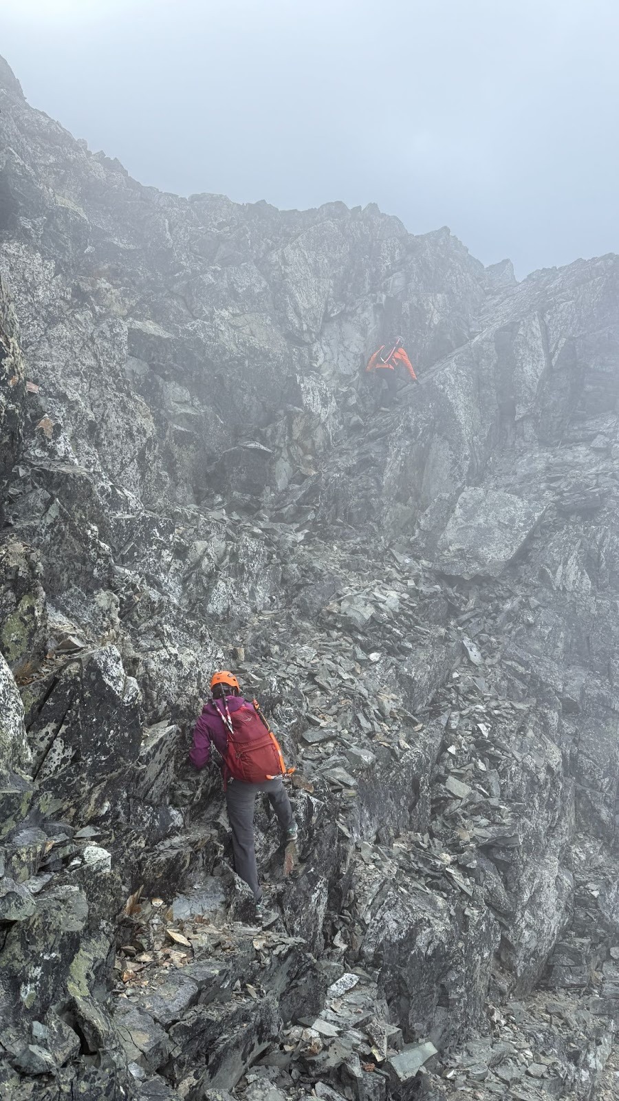

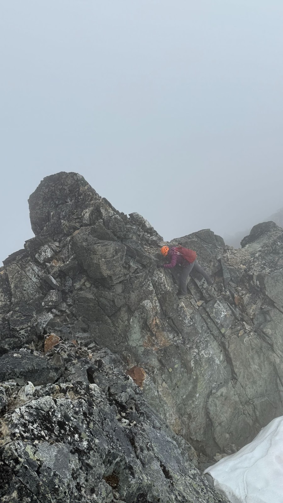
At times, we’d commit to a route only to be forced to retreat – confronted by cliffs or tall boulders with no easy way down. After a few such detours, we fell into a rhythm: scouting options individually and communicating before committing to a choice. This worked well and as time passed, our familiarity with the terrain increased. In the latter half, the route finding started to feel more intuitive even when we couldn’t see our way beyond.
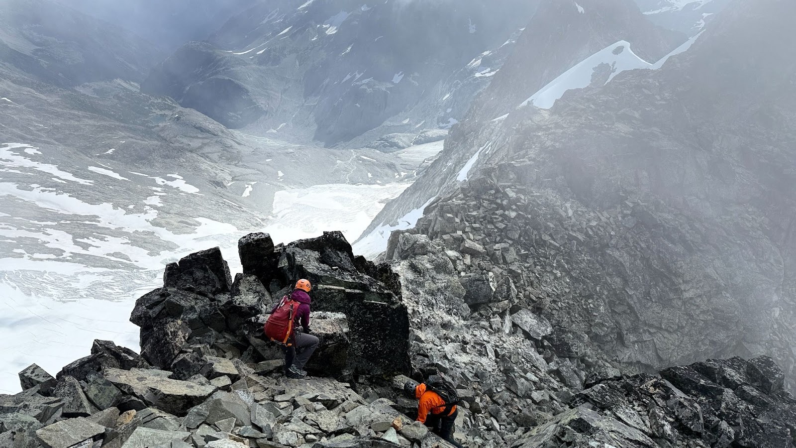
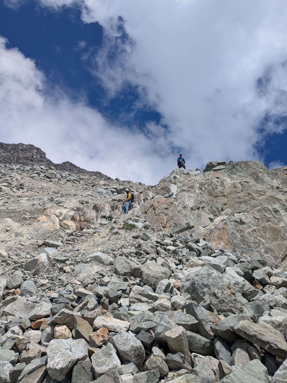
Overall, the traverse to the base of Mount Weart was a sustained Class 3/4 scramble and took us about three hours. The trickiest section was a downclimb from a false summit that felt technical but still within Class 4 territory. We tackled it from the climber’s right side rather than attempting a direct descent.
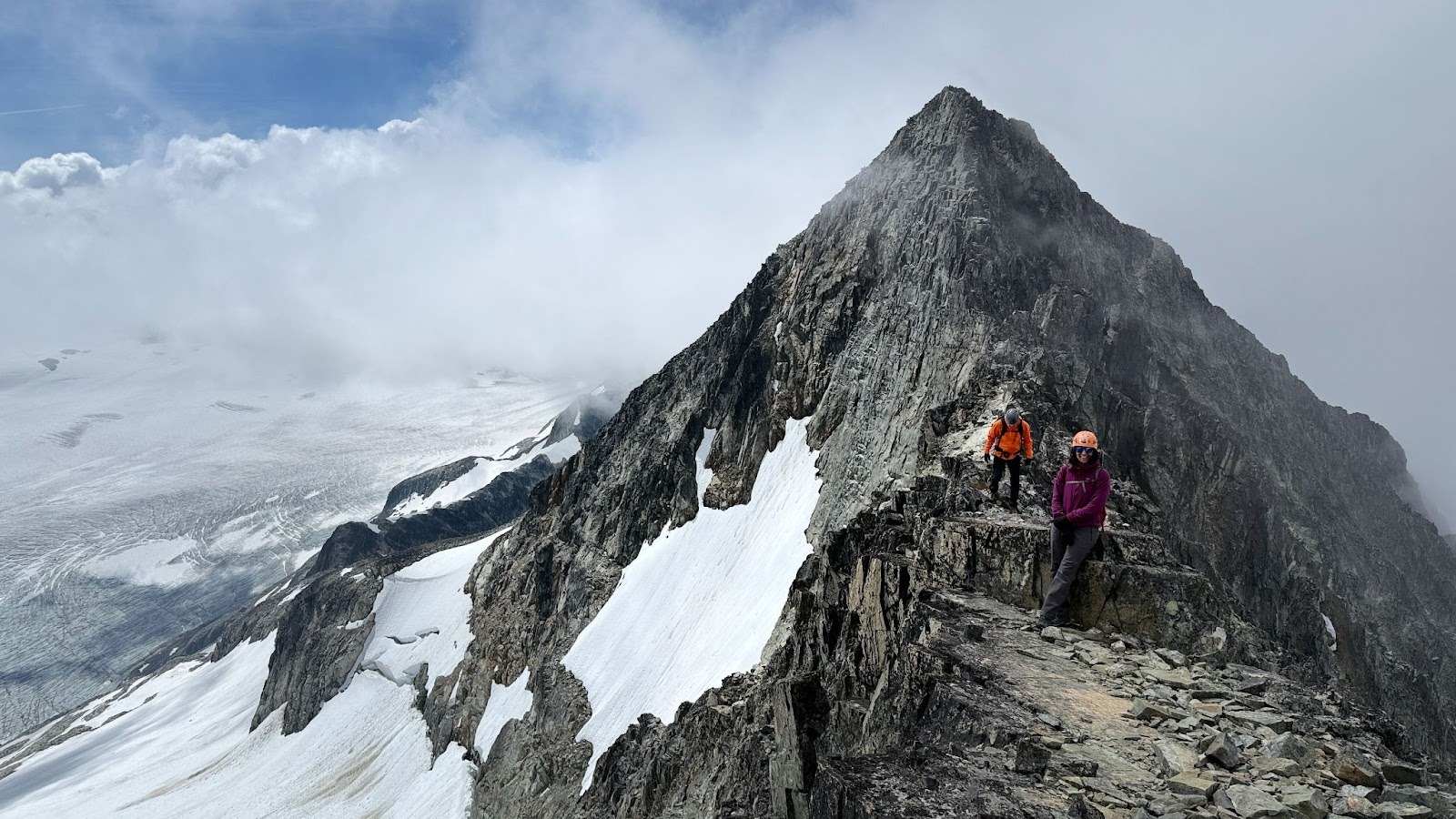
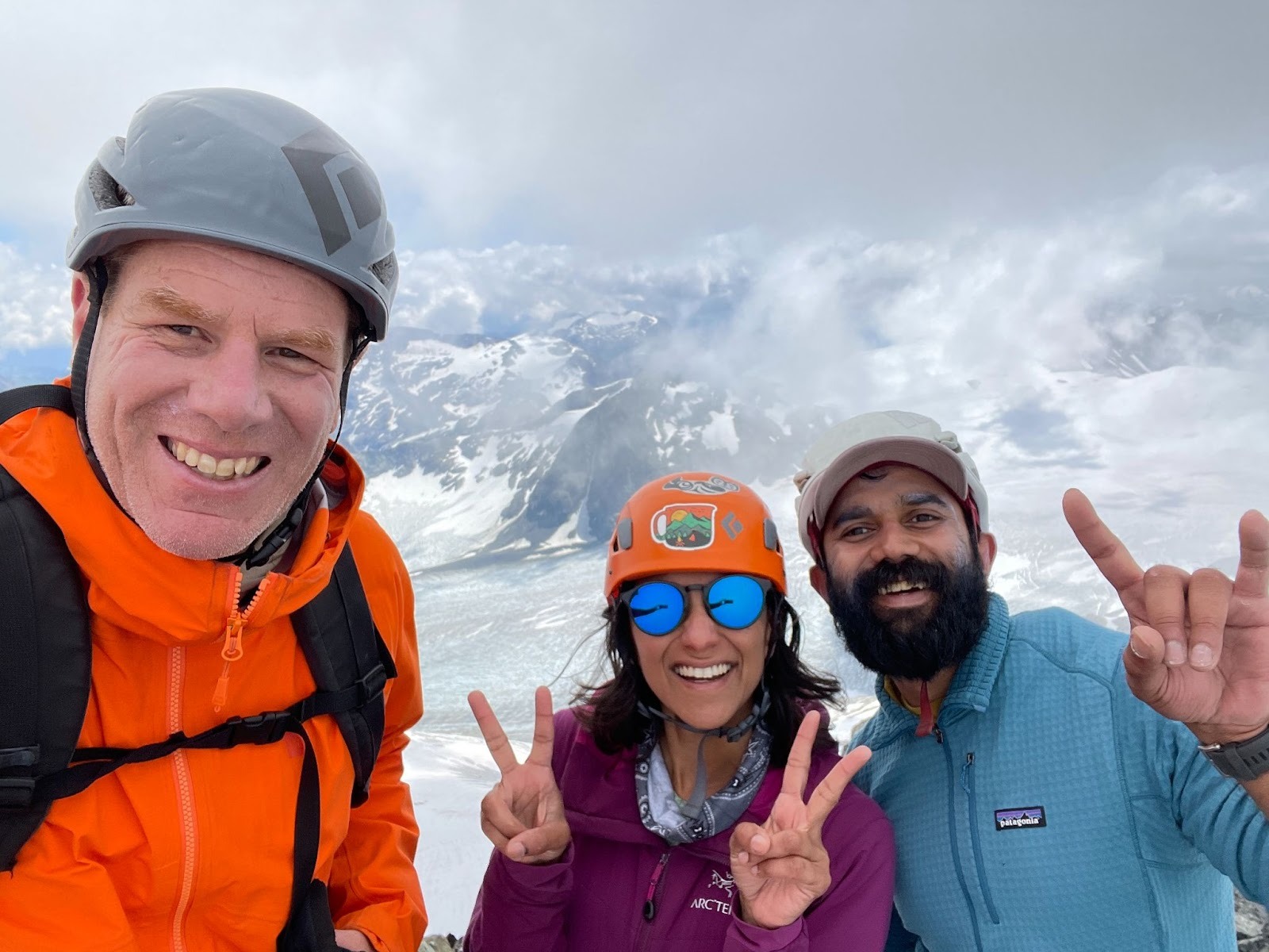
The final push up Mount Weart looked intimidating from a distance but the route always presented itself as we approached and we found lots of ledges along the way. As we reached the knife-edge, the clouds finally parted and Weart summit welcomed us with majestic views all around!
Going down Mount Weart
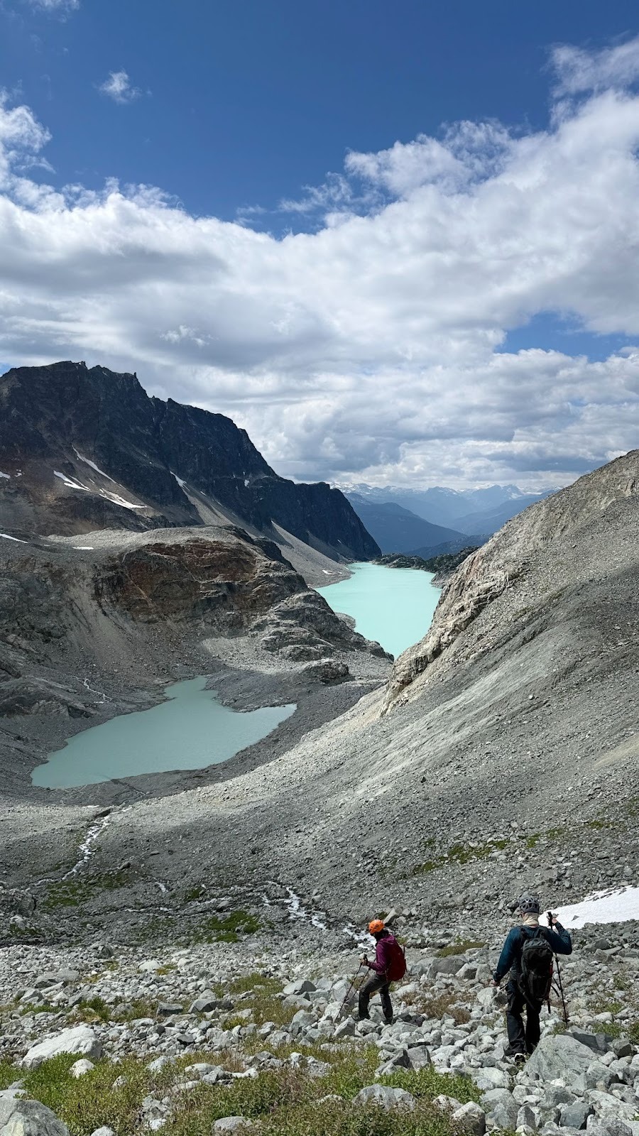
We spent a few quiet minutes on the summit, taking in the vast expanse of the Weart Glacier and the panoramic views of Wedge, Parkhurst, and Rethel mountains. A long descent lay ahead, so we didn’t linger. The initial stretch to a col felt straightforward, though it was full of loose rocks and talus. From the col onward, the descent began to live up to its rough reputation. We found ourselves navigating a minefield of unstable moraine, dust, and scree as we worked our way down to the first glacial lake basin. There was some route-finding involved, but cairns guided us, and we reached the basin without too much trouble. The lake was in the process of melting and therefore not crossable.
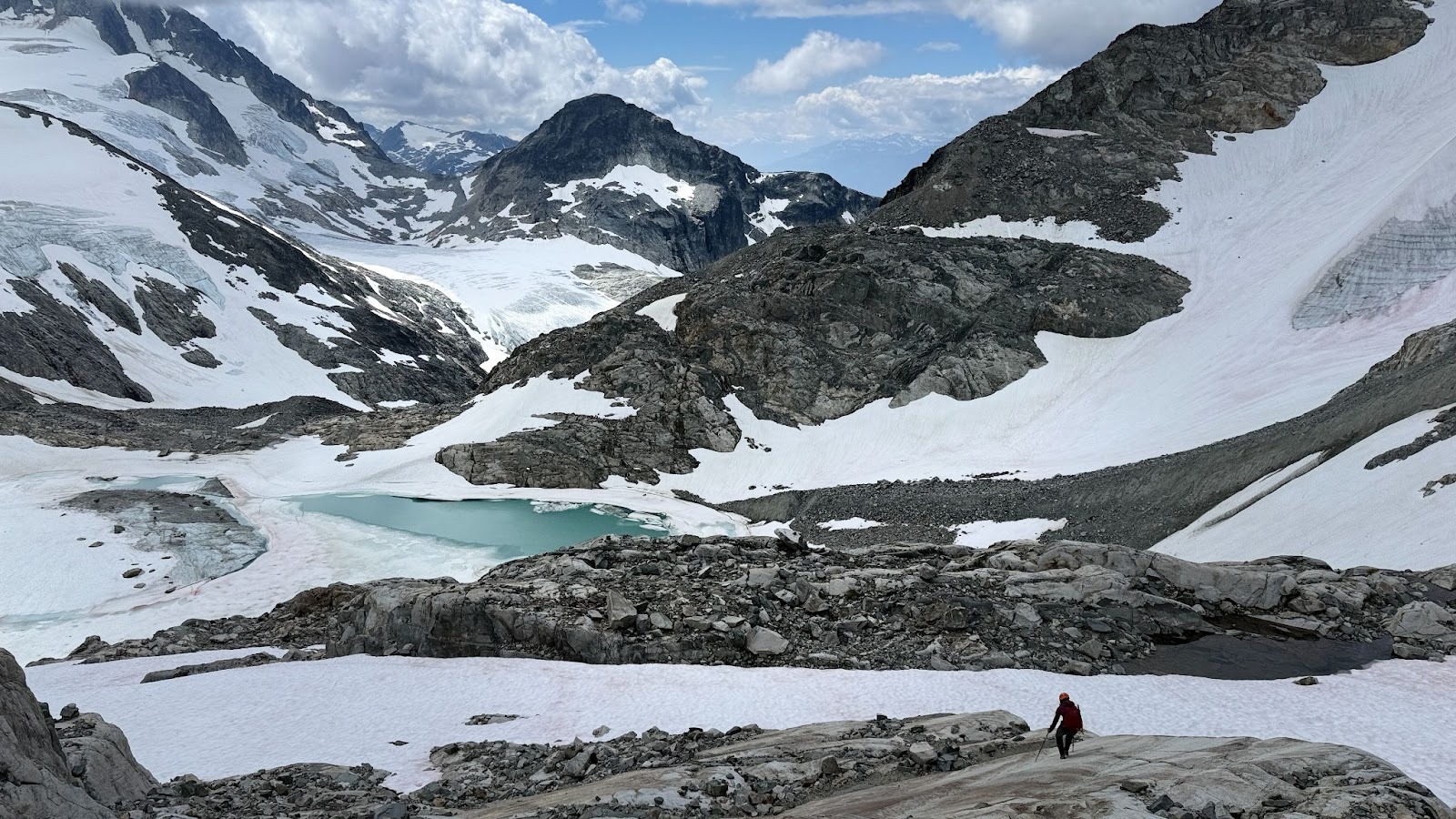
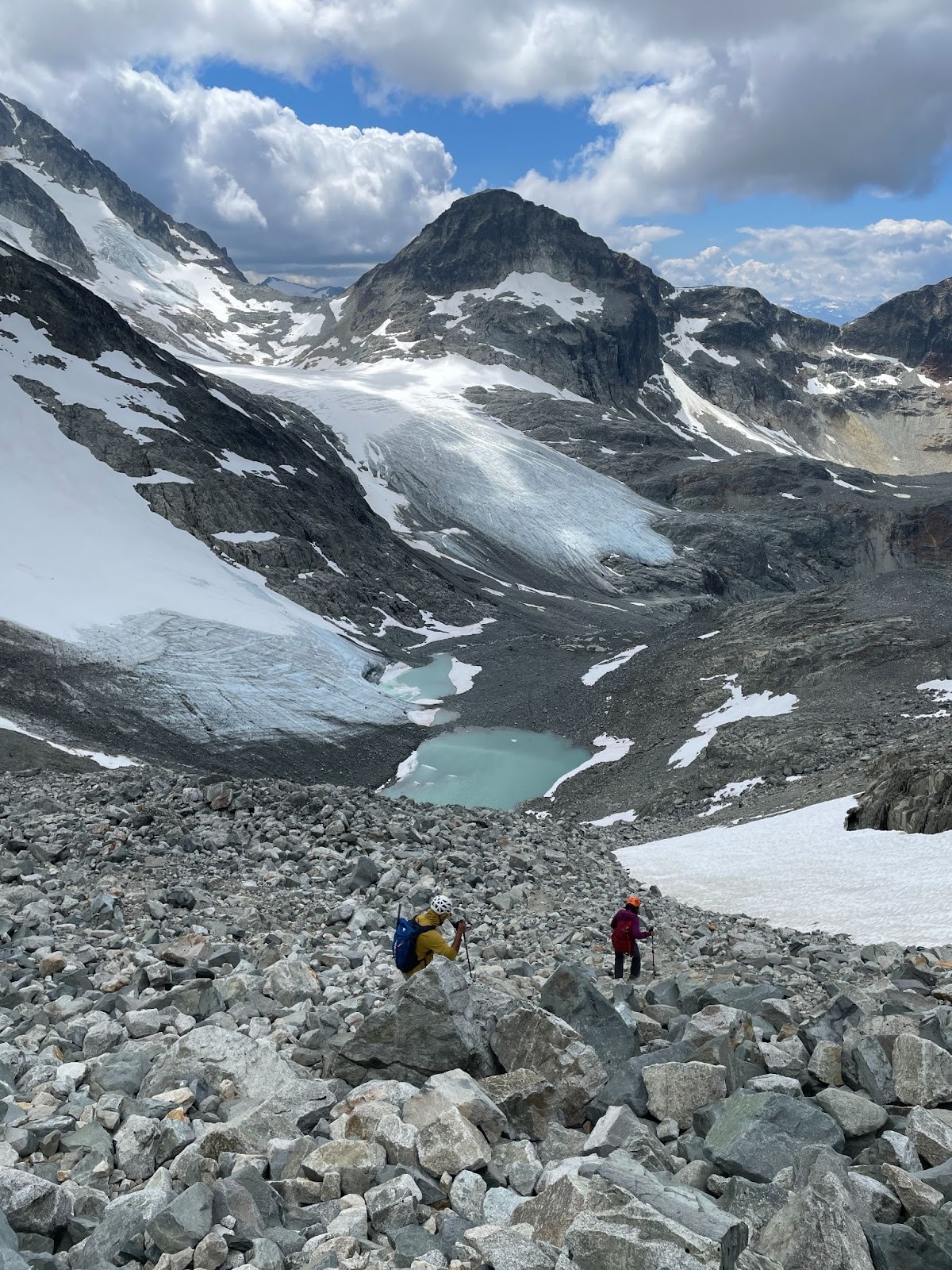
After weaving through a patchwork of moraine and melting snowfields, we arrived at the edge of a cliff overlooking the second glacial lake basin—and the real challenge began. Descending into this second basin was easily the worst part of the day. The slope was steep, the soil unbelievably loose, and nearly every step triggered movement beneath our feet. Despite our caution, we couldn’t help but set off small rockslides, so we moved in parallel to avoid endangering one another. We let out a collective sigh of relief when we finally reached the basin floor!
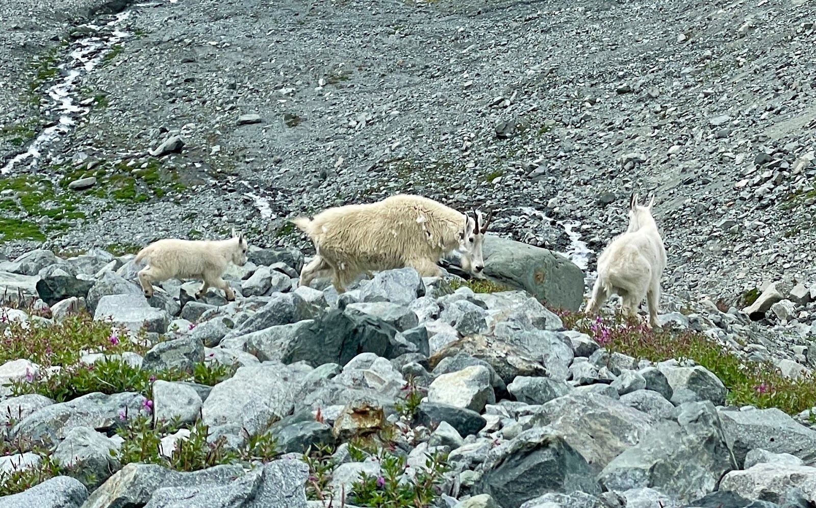
From the second basin, the route goes down to Upper Tupper lake alongside a creek. We encountered a cute family of mountain goats here! They paused their grazing in the meadow to eye us suspiciously, then reluctantly stepped aside as we passed along the narrow trail.
The rest of the descent went smoothly, involving a few creek crossings but no major obstacles. Back at Wedgemount Lake, we paused one last time to admire the traverse we had completed and began packing up camp for the final hike back to the parking lot.
The Armchair Traverse had been a true alpine adventure, marked by enjoyable scrambling, sustained route-finding, wild landscapes that felt straight out of Mordor, and most of all, excellent teamwork!


Leave a comment